Two maps that explain what DC might look like as a state
On Monday, Congress considered DC statehood. But what would DC actually look like if it became a state?
Maps by Geoffrey Hatchard for Neighbors United for Statehood.
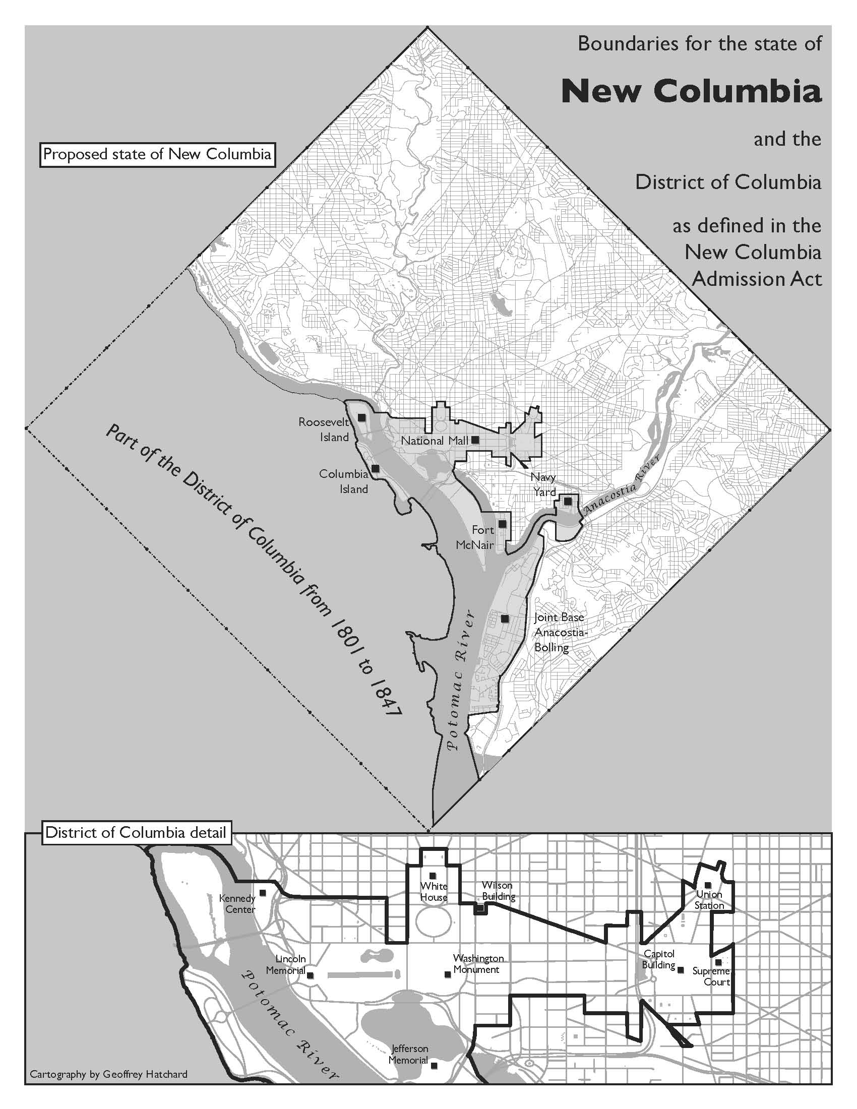
The most likely path to statehood for the District would shrink the federal city to a tiny section surrounding the National Mall and other federal properties. That section would remain not part of any state. The rest of the city would then become the 51st state, possibly called New Columbia.
Here’s a zoom-in to what would become the remaining federal city.