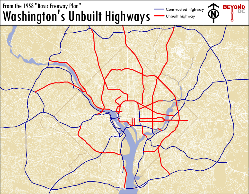
Washington’s unbuilt highways
This is a map of the Washington that almost was.
If mid-century planners, dedicated as they were to driving and the clearance of historic neighborhoods, had their way. It is a map of the highway network proposed for Washington during initial planning of the Eisenhower Interstate System, in 1958.
Map based on 1958 Basic Freeway Plan. Click to enlarge.
Each of these canceled highways, shown in red on the map, has its own story. Some were canceled due to civic activism, others because later proposals in the 70s preempted them, and others due to good old fashioned sanity.
Because they were never built, entire neighborhoods that might have been wiped out were saved, downtown was never physically cut off from its surroundings (except to the south), and millions of dollars were reallocated to construction of the Metro. Because these highways were canceled, Washington is the beautiful, walkable, vital city that we know and love today.
Most other American cities weren’t so lucky. Their highways were built, their neighborhoods demolished, and their downtowns converted to parking lots.