1950 plan for DC shows never-built freeways
This article was first published on July 10, 2012. It’s interesting to look back at the region’s history, so we are sharing it again.
The 1950 plans for DC show massive efforts to remove people from so-called “blighted” neighborhoods, and give more fascinating and scary insights into the urban development mindset of the day. They also include a full-color map showing the many freeways then planned for DC:
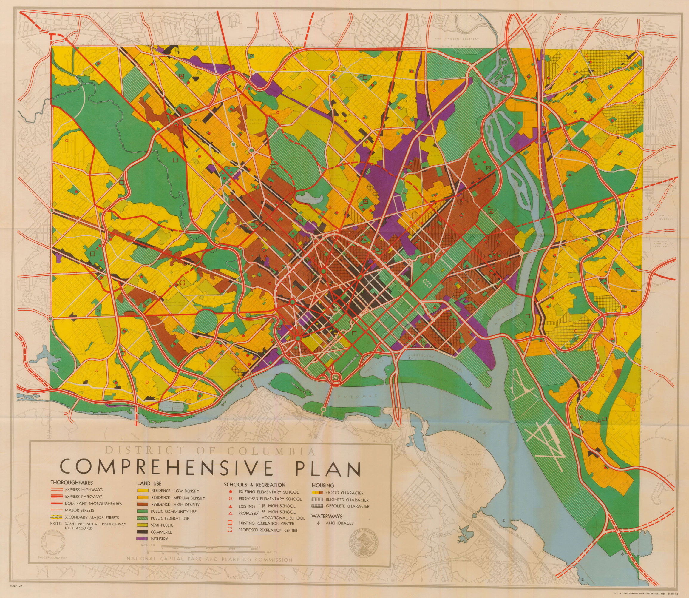
Portion of DC comprehensive plan, 1950. Image from Washington, Past and Future scanned by RayM on ShawNeighborhood. Click for full version.
The image above shows the inner ring, which would have demolished many of the buildings along Florida Avenue, T Street, and New Jersey Avenue to the current Center Leg I-395 at Third Street.
You can also see the proposal to extend the Mall eastward and wipe out a huge chunk of Capitol Hill.
The full image also shows a pair of freeways proposed to run through Battery Kemble and Glover Archbold parks to AU and Tenleytown, up Nebraska Avenue, weaving through Forest Hills, then across where Military Road is now, past Fort Totten along the Fort Circle down to the current Kenilworth Avenue/295 freeway.
Dan Malouff made this map a while back from the 1958 version of this plan:
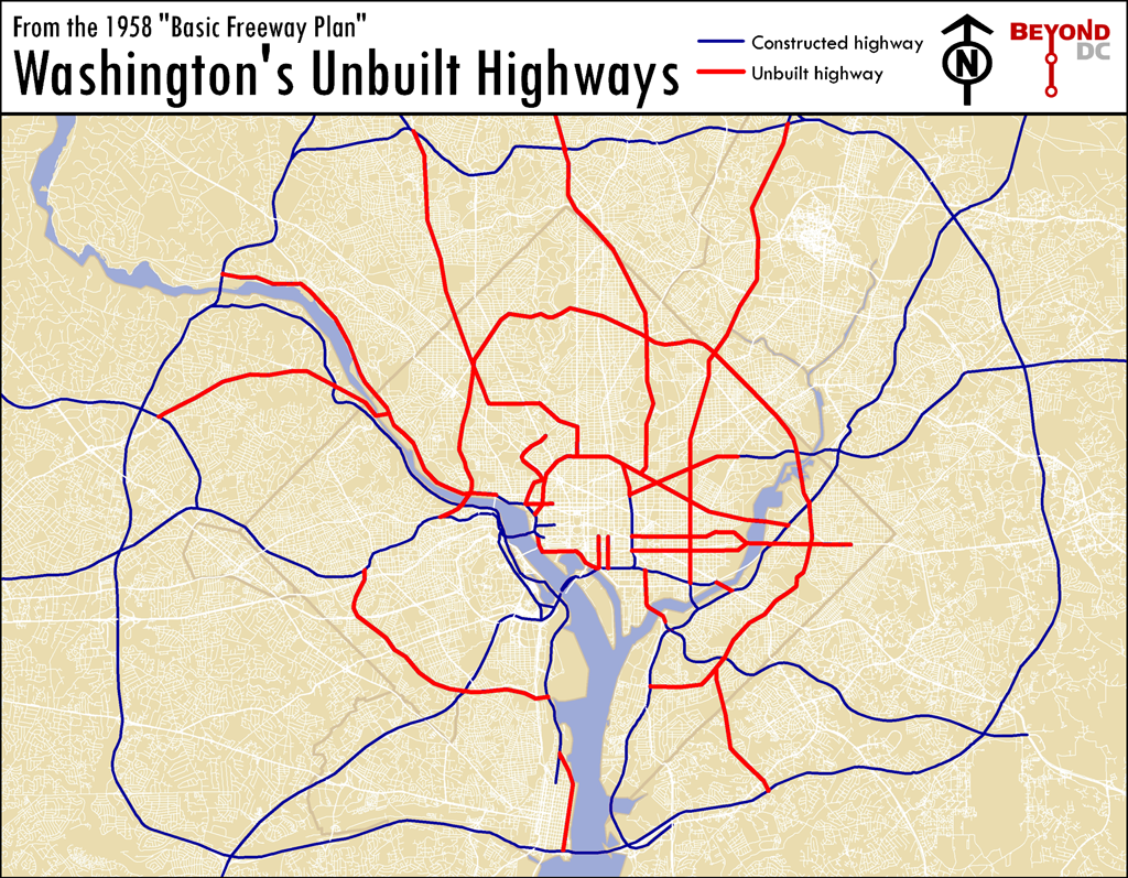
Map based on 1958 Basic Freeway Plan. Click to enlarge.
Much of the money slated for these projects instead went to construct the Metro.