Rising seas mean flooded streets for coastal Virginia

Flooded streets in Norfolk, Virginia after 2019's Hurricane Florence. Image by Dr. J Derek Loftis. Image used with permission.
Streets throughout coastal Virginia are flooding with growing frequency, as sea levels rise and rainfall across the Eastern Seaboard increases every year. In response, researchers, residents, and government officials are searching for solutions as to how coastal Virginia can respond to a changing climate.
Rising tides flood all streets
Despite ranking 37th in size out of all 50 states, Virginia has quite a lot of coast it could lose. The Fourth National Climate Assessment in 2017 estimated the odds of sea levels rising by up to four feet by the end of the century as “very likely.” That same report warned that taking no action to lower our carbon emissions could even cause sea levels to rise by eight feet or more by 2100.
Boasting the 8th longest shoreline in the country with 3,315 miles of waterfront means Virginia is disproportionately in danger.
For Dr. J. Derek Loftis, an Associate Research Scientist at the Virginia Institute for Marine Sciences (VIMS), the first step towards dealing with the threat is to understand the magnitude of the problem.
To that end, he and Dr. Joseph Zhang of the Commonwealth Center for Recurrent Flooding and Resiliency have installed over 40 water level sensors across the state since 2017.
By feeding the information from those sensors and the data from the Sea Level Rise app they developed through a forecast system called TideWatch, VIMS’ award-winning StormSense network can now predict flooding 36 hours in advance.
Norfolk, VA after 2016’s Hurricane Hermine. by Dr. J Derek Loftis. used with permission.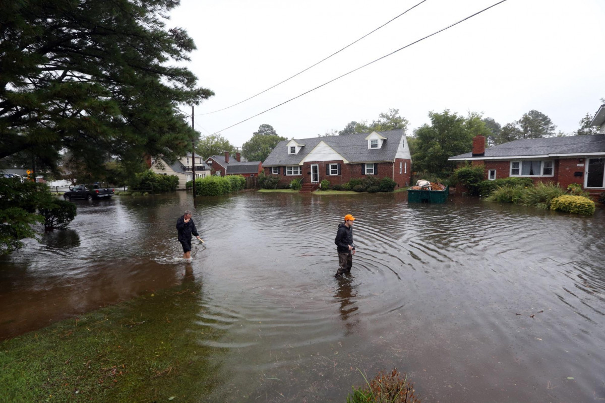
During one king tide in 2016, the system actually earned the Guinness World Record for the world’s largest environmental survey thanks to the help of over 900 volunteers crowdsourcing 59,000 info points from across the entire Eastern Seaboard.
Harnessing this network, officials in Newport News built out a grid of roadway sensors and an automated alert system to manage its most frequently flooded intersections.
The success of this pilot project inspired the Hampton Roads Planning District Commission to investigate installing such sensors across flood-prone areas throughout the Seven Cities, a nickname for the constellation of municipalities in the Hampton Roads region of Virginia which include: Chesapeake, Hampton, Newport News, Norfolk, Portsmouth, Suffolk, and Virginia Beach.
Without that technology in place wayfinding services like Google Maps or Waze all too often send drivers into flooded streets. Without cell phones there pinging their location, such services assume inundated streets are clear of traffic and will actually direct drivers into danger rather than steering them to safer, inland roads which may only be congested because they are the last routes not underwater.
While flooding certainly proves a headache for urban dwellers, for rural residents high tides and sinking streets can mean the difference between accessing the outside world or remaining trapped at home for days on end.
“Today in rural areas inundation is creating challenges where people can’t get out of their communities for 1-2 hours, but that figure is going to increase to 1-2 days as these types of flooding issues become increasingly problematic,” said Loftis.
While smart sensors and flood forecasting technology do nothing to tackle the larger problem driving increasing street inundation across the Commonwealth, systems like StormSense can help mitigate the impacts of climate change.