Images show how 80,000 people in a square mile look in different neighborhoods

Image by A high-density block in Columbia Heights. All images from Google Maps.
This article was first published on August 3, 2016. It’s interesting to look back at the region’s history, so we are sharing it again.
When we talk about dense housing, many think of New York City skyscrapers, or Soviet blocks. But as images of different neighborhoods in DC show, not all density looks the same.
Google Maps recently unveiled its auto-generated 3D imagery for DC. Using this feature, I compiled snapshots of what different levels of density — measured by people per square mile (ppsm) — look like throughout DC and Arlington. The population density numbers come from the 2014 American Community Survey, and I calculated at the census block group level.
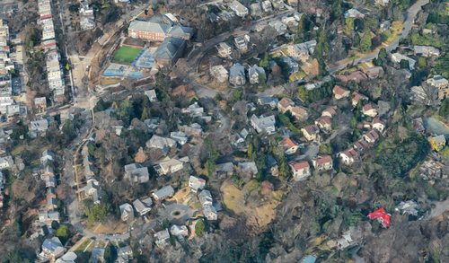
5,000 people per square mile
In the Palisades, winding streets are lined with large houses (~5,000 ppsm):
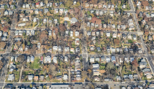
And in Brookland, detached single family homes sit on lots with front setbacks and spacious backyards (~6,000 ppsm):
15,000 people per square mile
Though walkable, most of Georgetown isn’t particularly dense, with blocks of tiny rowhouses clocking in at about 15,000 ppsm:
Lamond-Riggs achieves a similar population density with suburban-style duplexes (~13,000 ppsm):
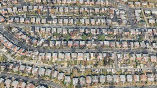
20,000 - 30,000 people per square mile
With a mix of both historic and new-construction rowhouses, this block group in Hill East sits at around 22,000 ppsm:
This section of Fort Dupont is similarly dense, but looks much different. Garden apartments centered around green space and surface parking give this area a density of roughly 27,000 ppsm:

30,000 - 40,000 people per square mile
In Glover Park, rows of attached houses line a network of relatively narrow streets (~31,000 ppsm):
A mix of duplexes and garden apartments puts this part of Shipley Terrace at about 35,000 ppsm:
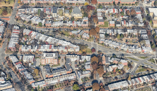
40,000 - 50,000 people per square mile
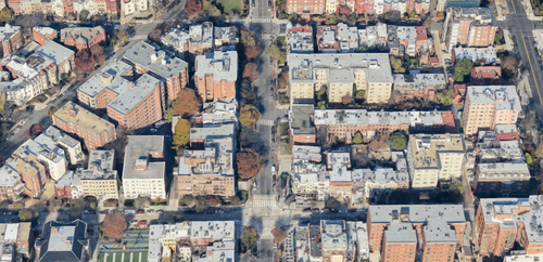
These blocks bordering the south end of Adams Morgan are almost entirely filled with large rowhouses, with a few bigger apartment buildings situated on the main thoroughfares (~45,000 ppsm):

In Rosslyn, parking lots and highways surround these 7- to 10-story apartment buildings (~47,000 ppsm):

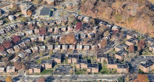
50,000 - 60,000 people per square mile
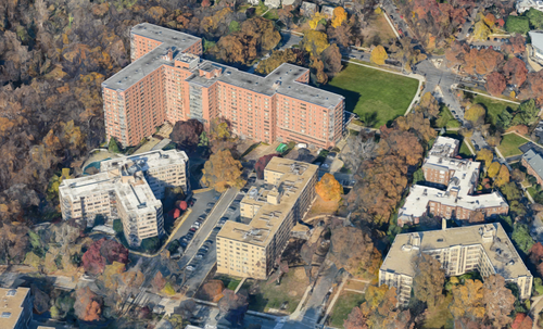
These apartment complexes on Massachusetts Avenue near American University don’t cover a lot of land area, but their height makes them relatively dense (~53,000 ppsm):
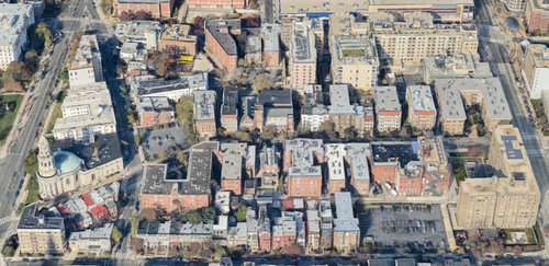
Dupont Circle’s streets blend rowhouses with 4- to 8-story prewar apartment buildings (~55,000 ppsm):
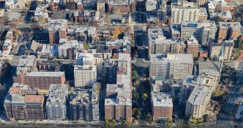
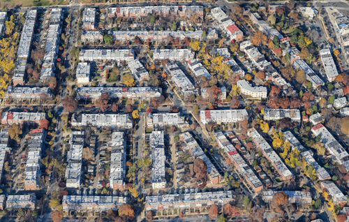
80,000+ people per square mile
This section of Columbia Heights is mostly close-together 4-story apartment buildings, giving it both a high density and a human scale (~80,000 ppsm):
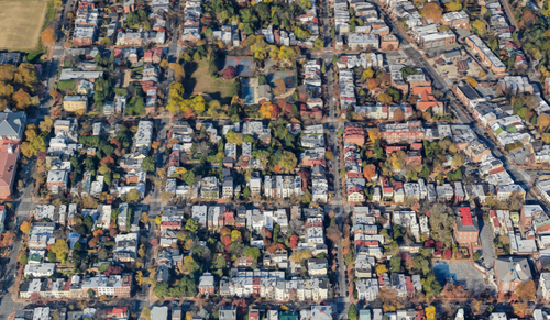
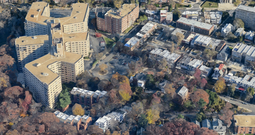
At the north end of Mount Pleasant, a large apartment complex pushes this block over 85,000 ppsm:
Just south of Logan Circle, bulky apartment buildings both old and new give rise to densities over 100,000 ppsm: