Here are the answers to whichWMATA week 145

On Tuesday, we featured the 145th challenge to see how well you know the Metro system. Here are the answers. How’d you do?
This week, we got 17 guesses. Ten of you got all five. Great work Peter K, Christopher Deal, Jay H, Alex B, and Charley Carson, Kwasi, James D, ArlFfx, Benjamin Nieva, and Brian J!
Note: Apologies for the delay in running this post. Unforeseen circumstances prevented it from running on Thursday as scheduled.
Image 1: Huntington 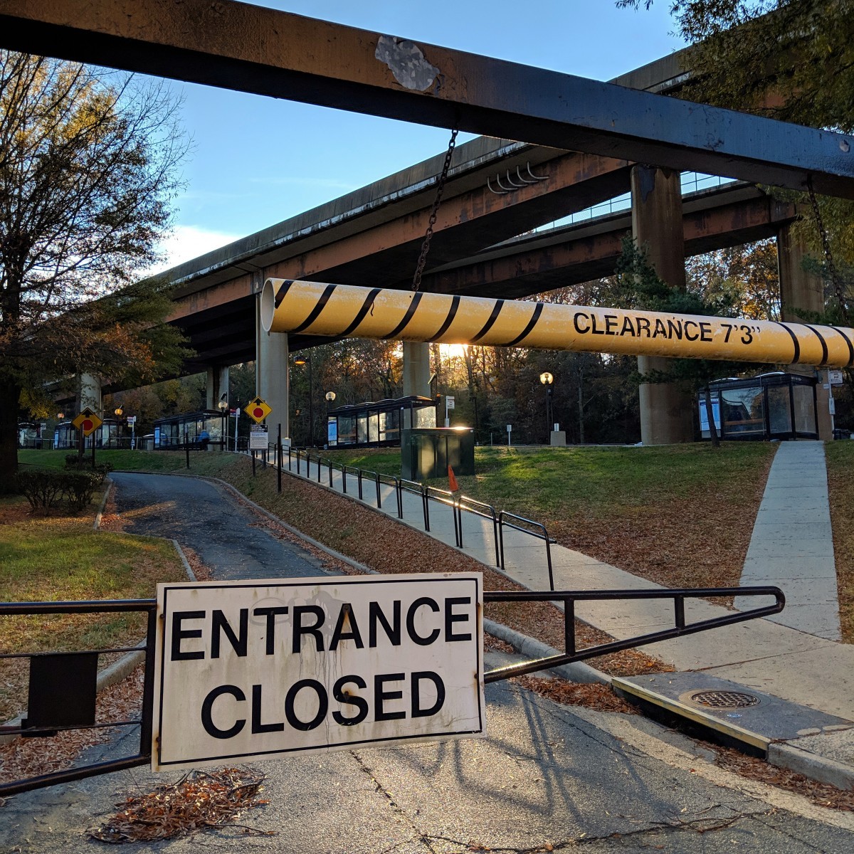
The first image shows a closed gate to a parking lot at Huntington station’s northern entrance. Other clues include the bus loop located under the high viaduct carrying the Yellow Line toward Eisenhower Avenue.
Seventeen of you knew this one.
Image 2: National Airport 
The second image shows a picture of a temporary sign in the southern mezzanine at National Airport. Currently, Blue and Yellow Line service is suspended south of the airport, and all trains are turning back there. As a result, the platform usually used for Huntington and Franconia trains is discharge only, and temporary signage has been added in the mezzanine.
For reference, the way WMATA is operating National Airport as a terminal is one of two ways.
At low traffic times, it appears that Metro is terminating all trains on the center track. Southbound trains coming from Crystal City cross over onto the center track, and open their doors on the Huntington/Franconia platform. Then they close those doors and open their doors on the Largo/Greenbelt platform. Once boarding is complete, the trains depart northbound and cross over onto the normal northbound track.
At higher traffic times, southbound trains are terminated on either the usual southbound track or the center track, with all discharge happening on the Huntington platform. Both trains then proceed south, with the train on the center track crossing over to the northbound track and the train on the southbound track continuing. The trains reverse south of the station and then come back northward. The train on the northbound track platforms on the northbound track and the train on the southbound track platforms on the center platform.
Fourteen of you got this one right.
Image 3: Farragut West
The third image shows the passageway leading from Farragut West into the International Square building (on the block bounded by 18th, 19th, Eye, and K Streets. In addition to the characteristic text of the word “square”, mirrored on other parts of the International Square building, the bronze tinted escalators were a clue.
Fifteen of you figured this one out.
Image 4: Anacostia 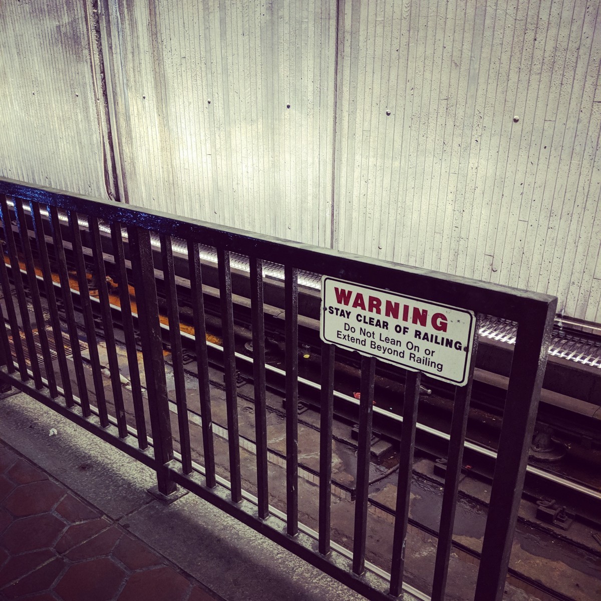
The fourth image shows the railing along the Branch Avenue track at the southern end of Anacostia’s platform. The Anacostia platform is a bit longer than it needs to be for an eight-car train. This is the result of the location where the entrances needed to be to avoid things on the surface. The station doesn’t have mezzanines below grade. The platform escalators and elevators go directly to street level. As a result, at both ends, fencing runs along the edge of the platform beyond the end of where an 8-car train would stop.
Dunn Loring has a similar configuration along the Vienna track, for access to the elevator. However, at that station, which is above ground, there is no trackway lighting shining up on the station wall, as is visible here.
Twelve of you guessed correctly.
Image 5: King Street 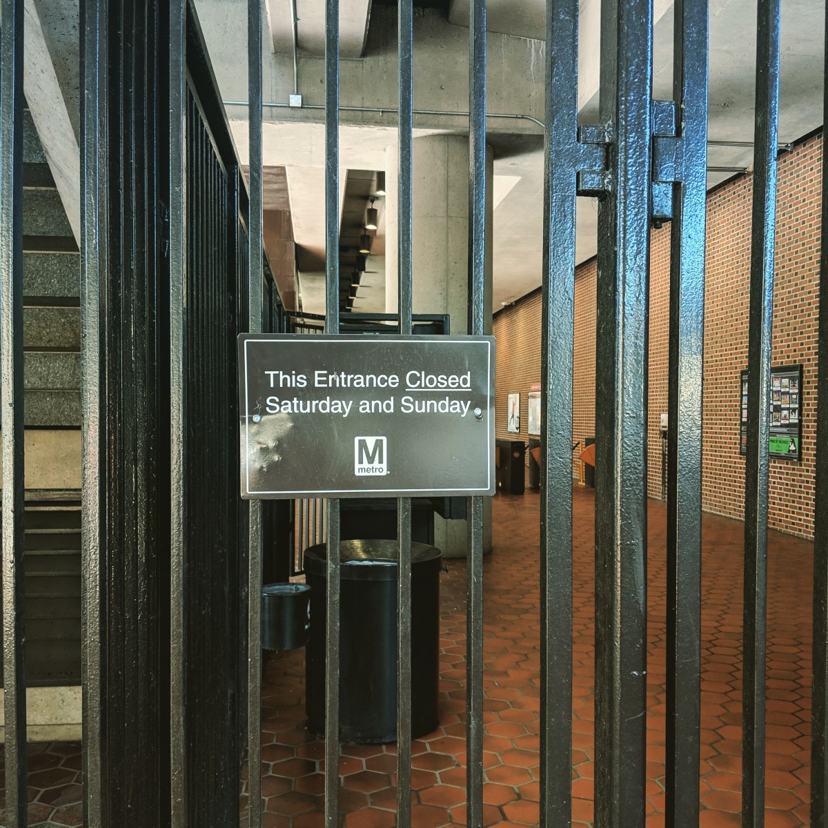
The final image shows a closed entrance at King Street. King Street has two mezzanines, the main original entrance, located south of King Street itself, and one at the north end of the station, along Commonwealth Avenue. At the main mezzanine, there are two entrances. One points toward the bus loop. The other points toward the southern sidewalk on King Street, and provides a shorter route for passengers transferring between Metro and VRE/Amtrak at Alexandria Union Station. However, that secondary entrance is closed on weekends.
Fourteen of you came to the correct conclusion.
Great work, everyone. Thanks for playing! We’ll be back in two weeks with challenge #146.
Information about contest rules, submission guidelines, and a leaderboard is available at http://ggwash.org/whichwmata.