Here are the answers to whichWMATA week 140
On Tuesday, we featured the 140th challenge to see how well you know the Metro system. Here are the answers. How'd you do?
This week, we got 17 guesses. Just six of you got all five. Great work Peter K, AlexC, Mike in Petworth, kellyzdude, ArlFfx, and Patrick B!
Image 1: Van Ness 
The first image shows the eastern entrance to Van Ness station. Some of you may have recognized the leafy surroundings of Upper Northwest. Others of you spotted the partially-hidden CVS sign behind the escalator canopy. This one appears to have been a pretty easy guess for most of you.
Fifteen of you knew this one.
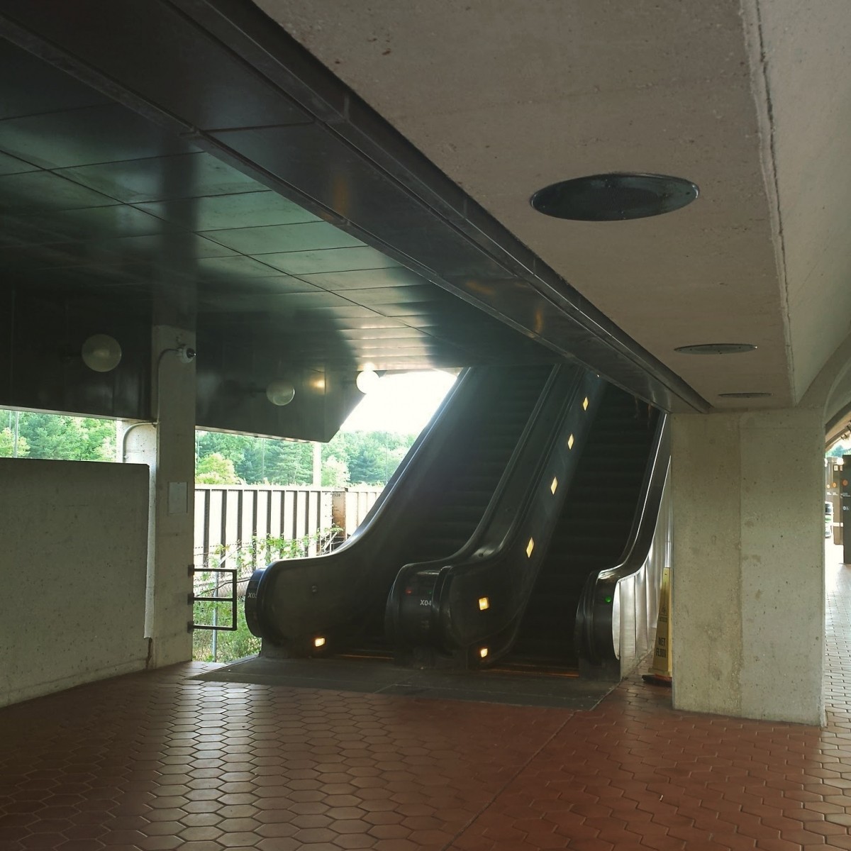
Image 2: Cheverly
The second image shows a view of the platform-to-mezzanine escalators on the New Carrollton platform at Cheverly. This is one of only a few outdoor stations with side platforms. It is one of two side-platformed stations with a Gull I canopy.
But the real clues here include esalators going up to the mezzanine, which doesn't happen at any other outdoor station with side platforms, and the parked freight train cars on the Landover Subdivision in the background. Cheverly is located between the freight-only Landover Subdivision and the electrified Northeast Corridor, which is home to Amtrak and MARC trains.
Twelve of you got this one right.
Image 3: National Airport 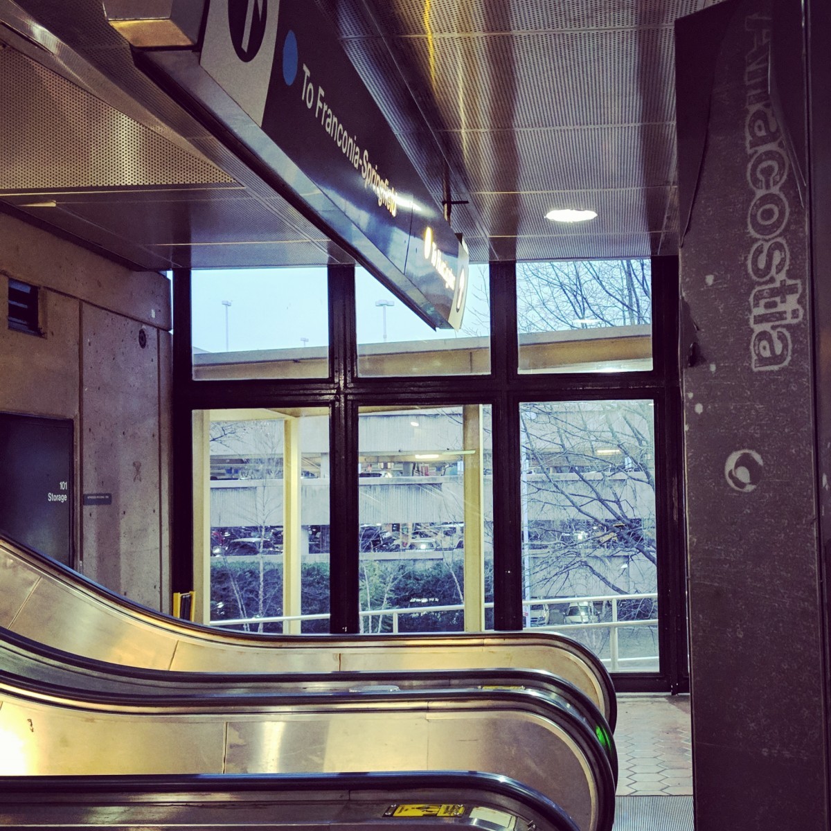
The third image included a red herring, which none of you fell for. The pylon includes faded text clearly reading “Anacostia”, but this station is definitely not Anacostia. It's National Airport. It shouldn't have taken you much thought to discount Anacostia from the possibilities, since the Blue and Yellow lines don't call there. Other clues to point you to National Aiport include the parking garage in the background, and the yellow canopy supports just outside the mezzanine windows.
I do not know the backstory for why there's a pylon with “Anacostia” written on it at this station. However, this was never directional signage, as some of you intimated in the comments. The only time text is written vertically on a pylon is when it is the name pylon for the station where it's located. I suspect that this pylon was either originally located at Anacostia and was removed or was originally slated to be installed there, but for some reason it was used at National Airport instead.
I should note that the faded Anacostia wording was actually covered with a darker material, which has peeled back except at the top corners. So when this pylon was installed, it would have been smooth brown, perhaps with some text on top. But that outer layer has peeled off revealing the “Anacostia” base.
All 17 of you figured this one out.
Image 4: Eisenhower Avenue 
The fourth image shows a view looking down toward the mezzanine from the Mount Vernon Square platform at Eisenhower Avenue.The layout should have indicated to you that this is a side platform station. There aren't many outdoor side platform stations, and the ceiling over the stairway should've pointed you toward the Gull I canopy type. The taller buildings reflected in the window at left may have also helped you narrow this down.
Twelve of you guessed correctly.
Image 5: East Falls Church 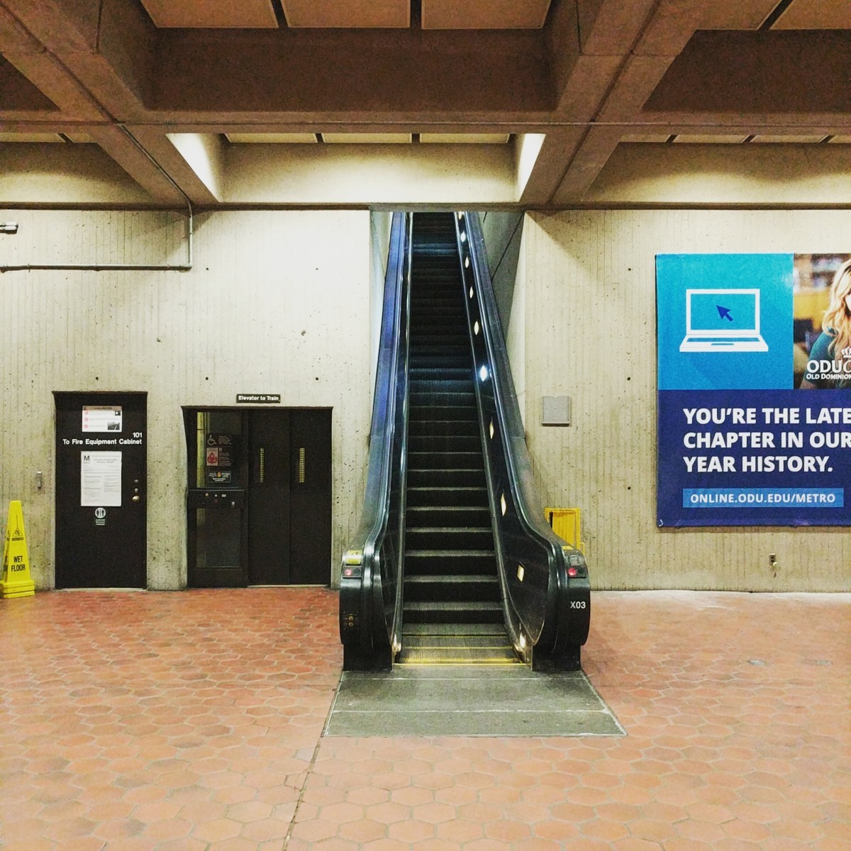
The final image was definitely the most challenging. This view looks westward from the just behind the main escalator bank in the mezzanine at East Falls Church. At East Falls Church, the mezzanine is rectanguar, with the opening facing east.
Behind the line of faregates and the station manager's booth, there is a pair of escalators leading up to the platform. Behind those escalators, there's a third escalator next to an embedded elevator. As we've discussed in past whichWMATA answer posts, solitary escalators are a pretty rare sight in Metro (at center platform stations, at least), so this is a fairly unique view.
Nine of you came to the correct conclusion.
Great work, everyone. Thanks for playing! We'll be back in two weeks with challenge #141.
Information about contest rules, submission guidelines, and a leaderboard is available at http://ggwash.org/whichwmata.