Ask GGW: The Glebe Road curve

From Reader M.
Reader M asks why an Arlington County road has a very strange curve that looks like a part of an interchange that was never completed:
I drive on this section of Glebe Road often, near the Chain Bridge and wonder why the curve was designed this way. I tried researching for some sort of unbuilt interchange, but had no luck. Do you know any GGWers who are good at sniffing this stuff out? It’s not even on Wikimapia.
To answer this question, we found a wealth of resources from Arlington County, which provides electronic copies of its historic General Land Use Plans.
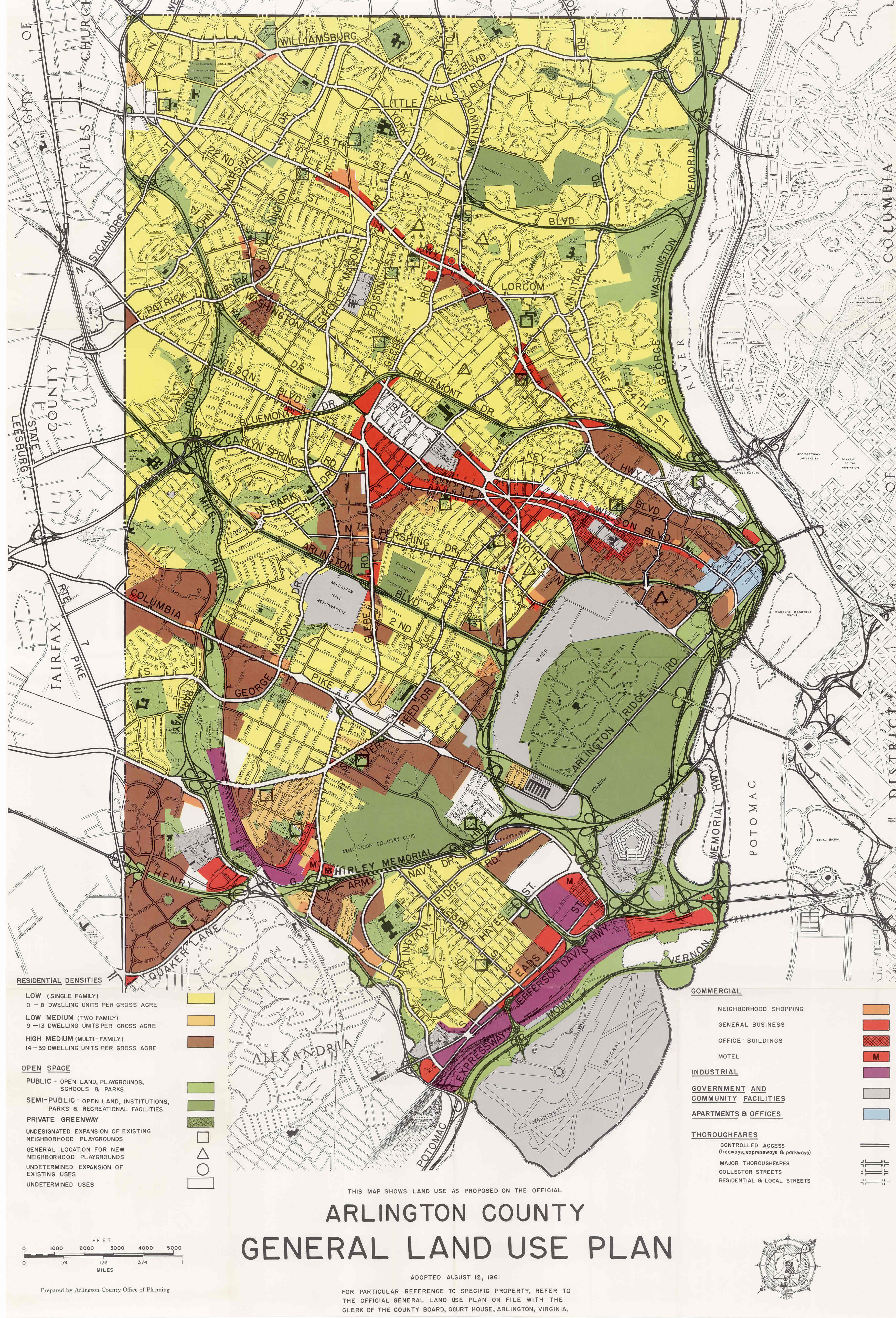
As can be seen in the 1961 Plan, This section of Glebe Road was designed to be part of a wye (or ‘Y’) interchange with the George Washington Memorial Parkway and also with a new bridge proposed to connect with Arizona Avenue across the river in the District.

Glebe Road and the Chain Bridge, from the 1961 Arlington General Land Use Plan
This interchange remained on the books until 1975, when the County removed the proposed bridge and a number of other road projects (including, for a period of four years, I-66) from its Plans.

Glebe Road and the Chain Bridge, from the 1975 Arlington General Land Use Plan
On a related note that may become a later post on Greater Greater Washington, and as recounted by Zachary Schrag, Arlington County at the time was in a war with the state and the Federal Highway Administration over Interstate and Metro plans. In 1979, I-66 was restored in a compromise with the two other parties to run Metro underground in Arlington. However, the two other proposed bridges (the I-266 Three Sisters Bridge near Spout Run Parkway, and the Arizona Avenue Bridge suggested above) never made it back in after various battles.