If you put the DC Beltway around other cities, how far out would it go?
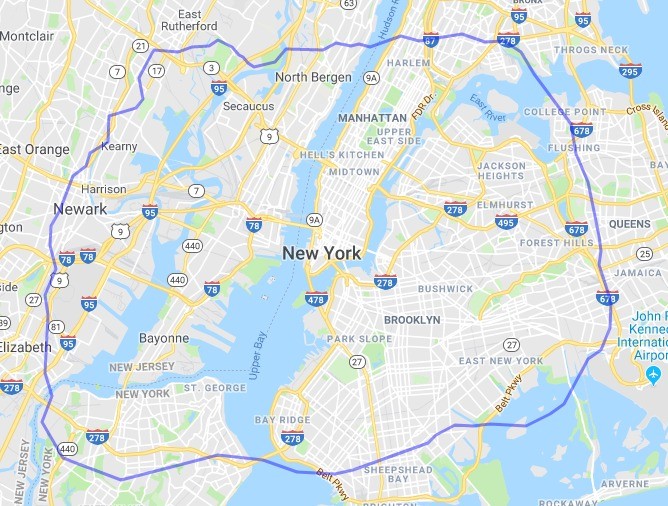
The Beltway over New York. Image by author using MAPfrappe.
The Beltway is one of the Washington's region's most well-known geographic features. Its ring around DC forms an unofficial boundary between the region's core and rim. Would that hold true if it were around another city? How does the Beltway compare to other ring roads?
If you picked up the Beltway and plopped it atop other cities, and corrected for map projection differences, this post explores how it would look amid their geography.
Atop New York, the Beltway reaches from Newark to Queens. The Verrazzano Narrows Bridge fits neatly near our Wilson Bridge. To the north, Bronx is mostly outside the Beltway, as is the northern tip of Manhattan.
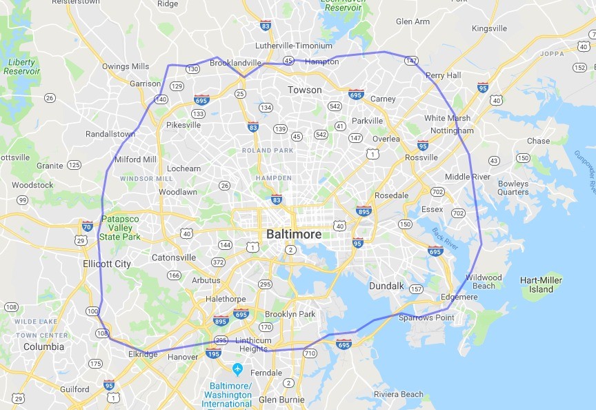
Baltimore, Washington's neighbor to the north, is so close-by that it's no surprise how our Beltway fits almost completely over theirs.
Atlanta's beltway—the “Perimeter”—aligns more north-south than Washington's. I had always visualized ther Perimeter as noticably smaller than the Beltway, but correcting for projection it looks about the same in terms of area. Mercator strikes again.
The Beltway over Atlanta. Image by author using MAPfrappe and Google. 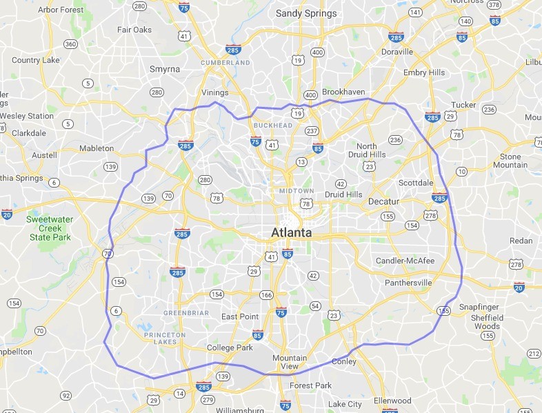
Boston's I-95 half-beltway is an almost perfect match for the west side of Washington's. To the east, Lynn to Quincy would make quite a bridge.
The Beltway over Boston. Image by author using MAPfrappe and Google. 
Chicago's relentless grid makes for a foreign-looking home to a ring road. The Beltway extends further west than Oak Park, but not as far north as Evanston.
The Beltway over Chicago. Image by author using MAPfrappe and Google. 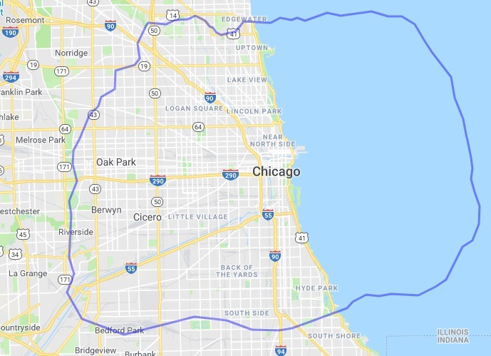
Dallas on the other hand clearly loves a ring road. Its beltway can almost completely contain Washington's.
The Beltway over Dallas. Image by author using MAPfrappe and Google. 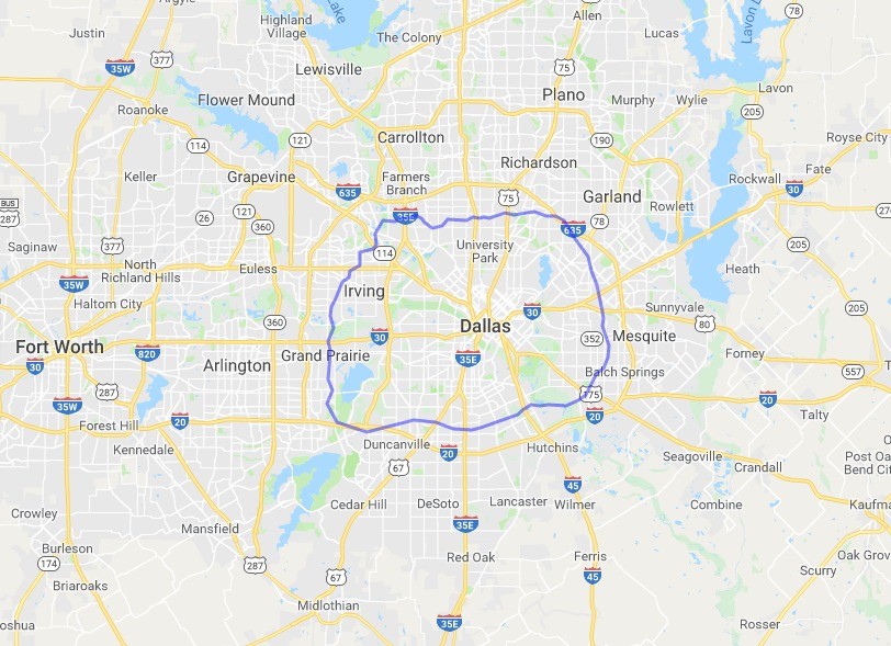
Houston may be even more ring road happy than Dallas. Washington's Beltway fits between the inner and middle of Houston's three main rings. Notably, Houston's inner ring is also the cultural dividing line between its urban core and suburban areas.
The Beltway over Houston. Image by author using MAPfrappe and Google. 
Not to dwell too much on Texas, but San Antonio is one more example that Texas loves its highways. Much like Houston, Washington's Beltway fits between the first and second of San Antonio's three.
The Beltway over San Antonio. Image by author using MAPfrappe and Google. 
Atop Los Angeles, it's clear how much larger LA is than DC. There are more than 12 million people in the LA urbanized area, compared to maybe five million in DC's.
The Beltway over Los Angeles. Image by author using MAPfrappe and Google. 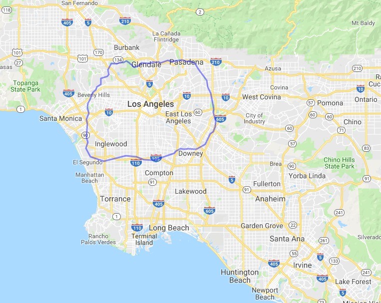
San Francisco is smaller in terms of land area than the District of Columbia, but this image makes clear how the rest of the Bay Area is much more distant from San Francisco than Arlington or Silver Spring are from DC.
The Beltway over San Francisco. Image by author using MAPfrappe and Google. 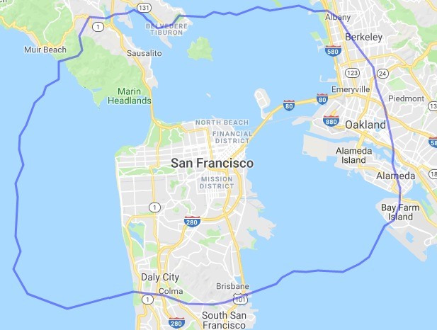
Seattle's geography isn't quite as isolating as San Francisco's. As a result, more of Seattle's metro area fits inside the Beltway footprint.
The Beltway over Seattle. Image by author using MAPfrappe and Google. 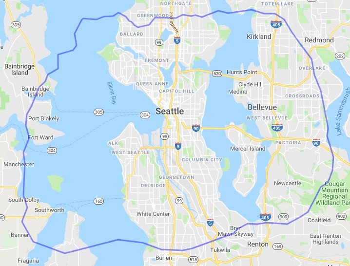
Leaving the United States, Toronto's 401 highway is about the same distance from downtown, and fulfills about the same role, as Washington's Beltway.
The Beltway over Toronto. Image by author using MAPfrappe and Google. 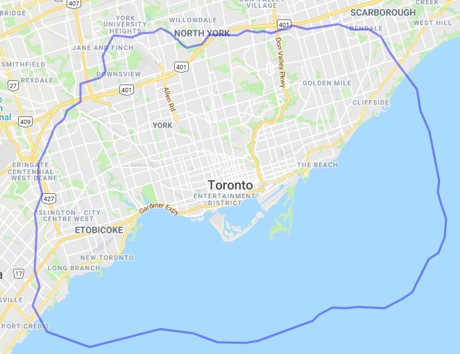
Mexico City stands as stark contrast to geographically gigantic Los Angeles. The Mexican capital fits the majority of its 20 million people into an area about the same size as Washington's Beltway.
The Beltway over Mexico City. Image by author using MAPfrappe and Google. 
Brazil's Sao Paulo is similar: Somewhere around 20 million people, most of whom would fit inside Washington's Beltway
The Beltway over Sao Paulo. Image by author using MAPfrappe and Google. 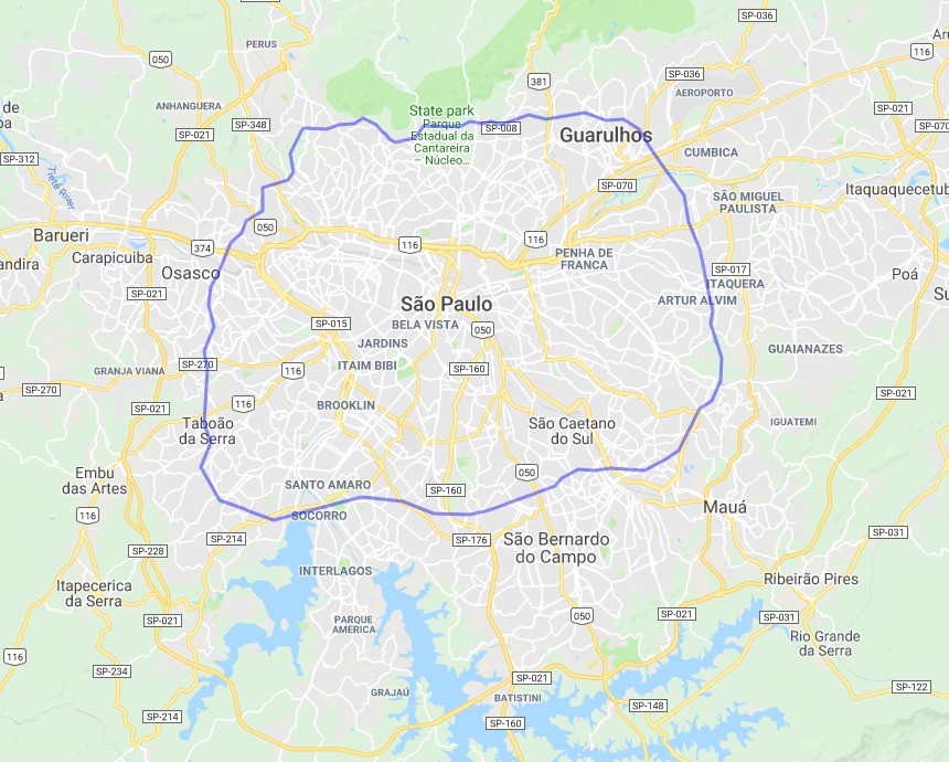
Brasilia, Brazil's Washington-esque planned capital city, appears quite a bit smaller than the Beltway, though it does sprawl further southwest.
The Beltway over Brasilia. Image by author using MAPfrappe and Google. 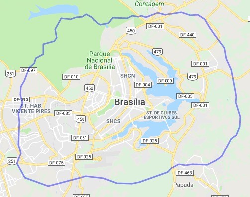
Heading across the Atlantic to Europe, London's famous M25 “Orbital” completely dwarfs DC's Beltway.
The Beltway over London. Image by author using MAPfrappe and Google. 
The situation is reversed in Paris, where la Périphérique would not even contain the District of Columbia, much less the entire Beltway.
The Beltway over Paris. Image by author using MAPfrappe and Google. 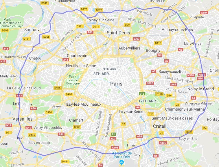
Moscow must be the world's beltway-iest city, with at twelve recongized rings, some of them rail. Washington's Beltway is about the same size as Moscow's “МКАД” ring, which conveniently forms much of the official boundary between the City of Moscow and the surrounding Moscow Oblast. Moscow's largest ring road, tha A-108, would run from Fredericksburg to Hagerstown to Aberdeen if it were over DC, and would drawf even the mightiest of Texan beltways.
The Beltway over Moscow. Image by author using MAPfrappe and Google. 
Beijing is probably the world's prime contendor against Moscow for ringiest city. Washington's Beltway is roughly the same size as Beijing's aptly named 5th Ring Road.
The Beltway over Beijing. Image by author using MAPfrappe and Google. 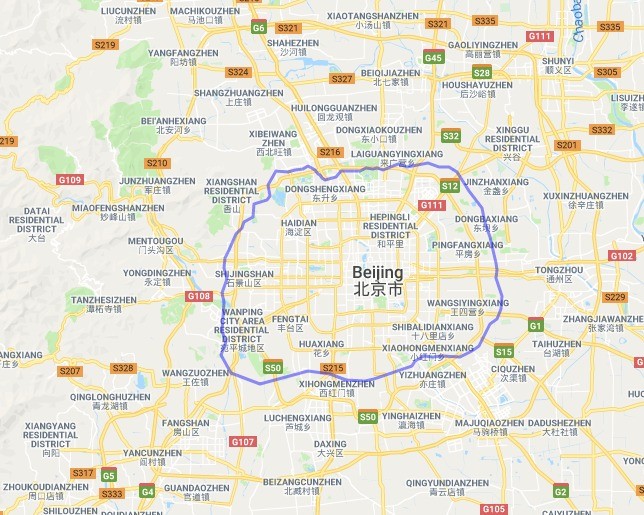
Shanghai looks like a Chinese Los Angeles, with the Washington Beltway a small and out-of-place hoop surrounded by a massive web of criss-crossing highways that extend far far beyond.
The Beltway over Shanghai. Image by author using MAPfrappe and Google. 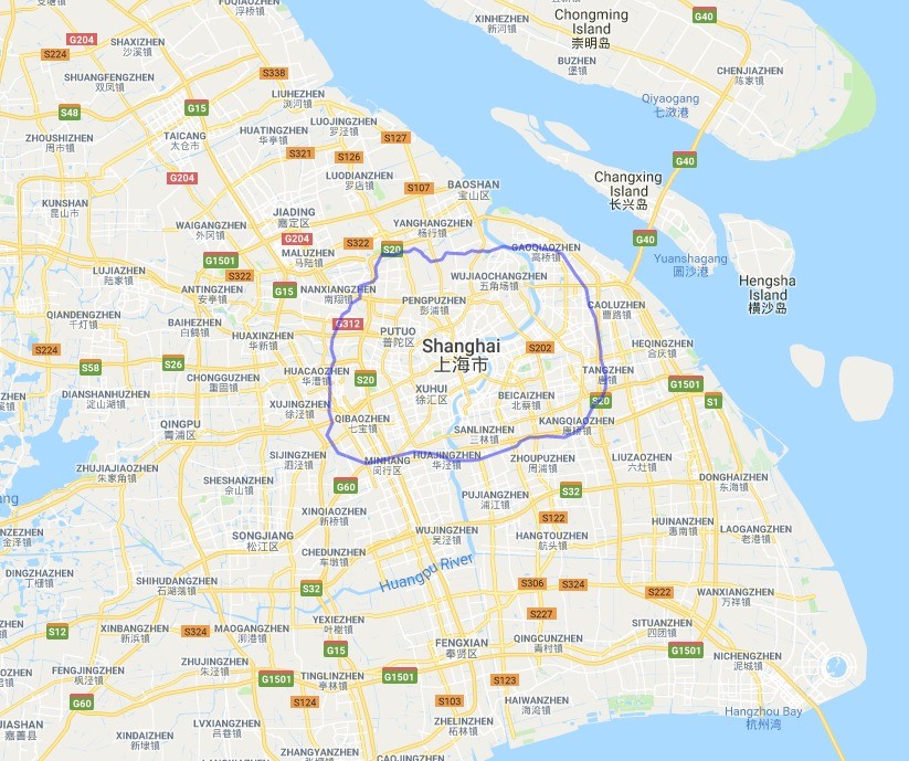
Finally, Tokyo, where Washington's Beltway covers about the same area as the Gaikan, the second of Tokyo's three major rings.
The Beltway over Tokyo. Image by author using MAPfrappe and Google. 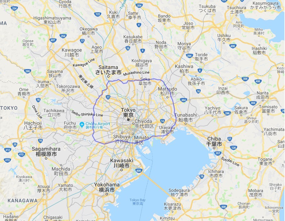
I made these maps using MAPfrappe, a website that corrects for map projection distortions. You simply draw a line around any place on earth, and then MAPfappe allows you to move that object to any other place on Earth, re-projecting it for the new location. It's easy, and great fun to map nerds.