Streetcars will “bridge the gaps”
The Transport Politic’s Yonah Freemark created some terrific maps of DC’s proposed streetcar network showing how streetcars will fill in the gaps between Metrorail lines.


Quarter- and half-mile radii around Metrorail stations (left) and proposed streetcar lines (right). Images by Yonah Freemark.
Freemark also created a great map showing the streetcar lines and Metrorail lines. As I’ve argued many times before, the Metrorail map forms many visitors’ and new residents’ view of the District. If one of the goals of the streetcar system is to bring tourists and casual travelers from around the region to areas we want strong economic growth, DC has to create a new iconic conception that includes these areas and the lines that lead to them. They could start by adding the Circulators.
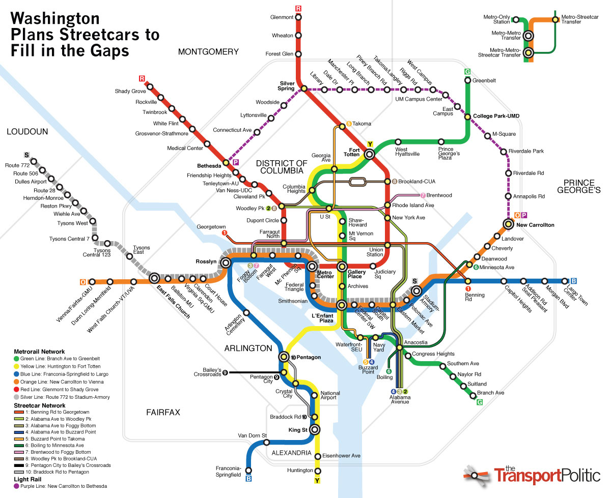
Image by Yonah Freemark.