These detours will help you bike during Montgomery County’s SafeTrack closures
As part of Metro’s sixth SafeTrack surge, trains are single tracking between Silver Spring and Takoma. To help those who use those two stations as well as the ones north of Silver Spring, Montgomery County has laid out a bike route that takes riders to the West Hyattsville Metro station, where trains are operating normally.
Metro’s sixth SafeTrack surge is the first to take place in Montgomery County, and on top of the single tracking, trains up to Glenmont and down to NoMa are only running 25% as often as usual. Officials are encouraging the 94,000 riders affected by this surge to seek alternatives like taking the bus or riding a bike, as well as teleworking.
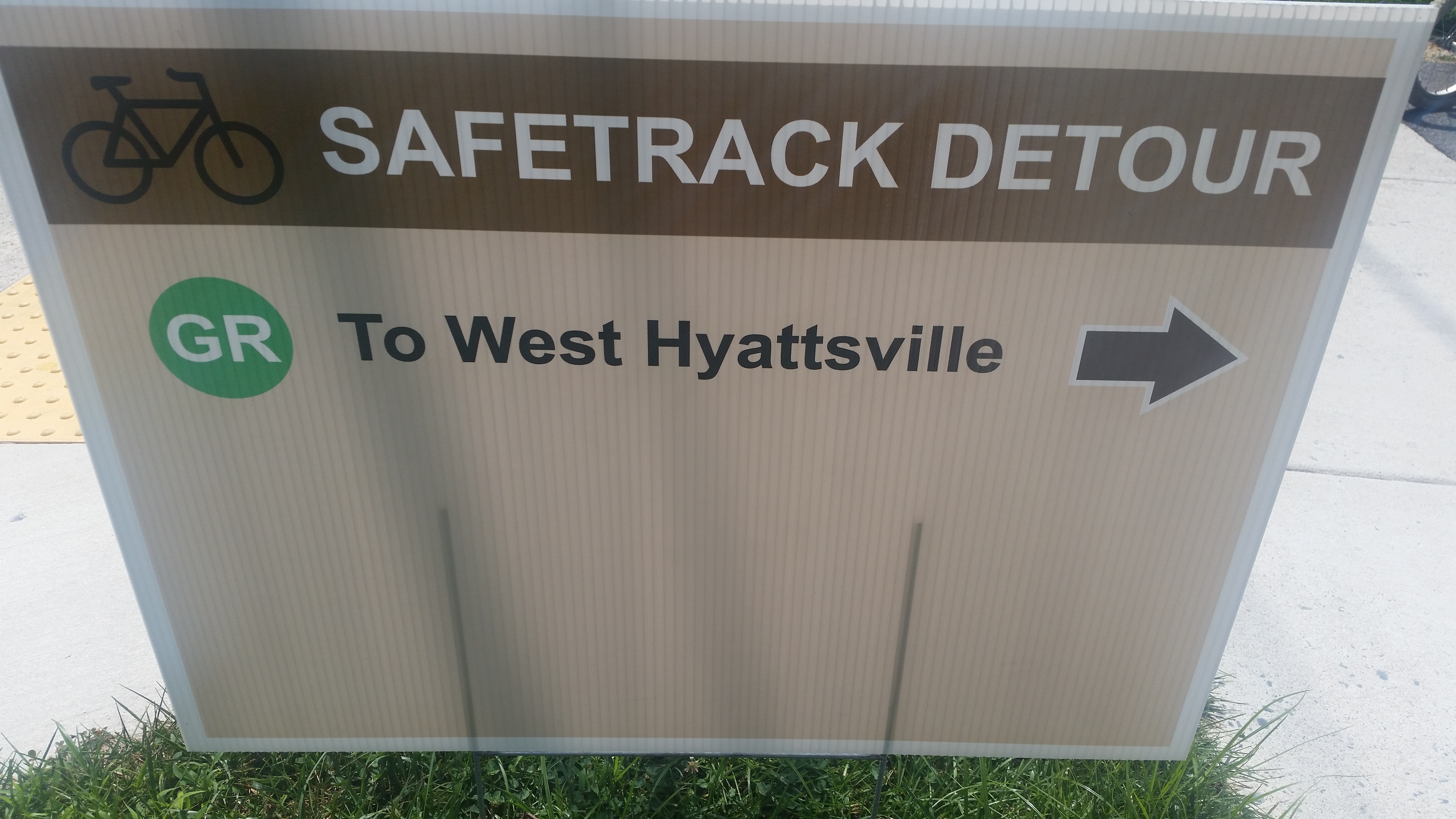
As part of the effort, Montgomery County’s bike planners designed a route that directs people from the Red Line stations affected by the current surge toward the Green and Yellow Line’s West Hyattsville station.
At the Glenmont, Wheaton, Forest Glen, Silver Spring, and Takoma stations, MCDOT designed and placed large wayfinding signs to guide people on bikes around the track work and along the route it designed.
Dennis Avenue at the Sligo Creek Trail. Photo by the author.
From Forest Glen, Silver Spring, and Takoma, the route runs almost directly to the Sligo Creek Trail, a trunk route whose end is near the Northwest Branch Trail, which runs next to the West Hyattsville station. Signs direct riders along a slightly more complex route from Glenmont and Wheaton.
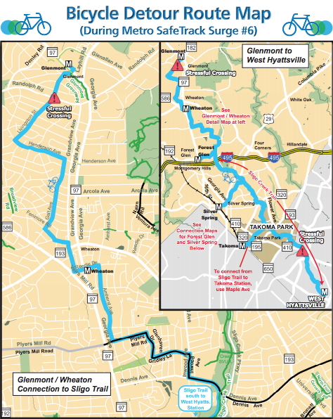
Map from Montgomery County.
The signs, designed by MCDOT just for this period, are the size of a political campaign sign, in bright colors, and placed conspicuously anywhere there is a turn in the route. They are temporary (and not made to withstand serious weather), so they’ll be gone at the end of the surge.
Anecdotally, the signs have been helpful to occasional and first-time bike commuters on Monday morning, filling in known gaps in the permanent wayfinding signs on both county and park property. Also, one person I spoke to wished there was additional information on the sign, or a link to it, such as a web site or QR code.
There aren’t directions west along the Georgetown Branch Trail to Bethesda because service is still slightly reduced on the western portion of the Red Line, but the bike route from Silver Spring to Bethesda is already marked with permanent signs.
For Surge 7, which will mean single tracking between Shady Grove and Twinbrook starting August 9th, the signs will highlight a single route from Shady Grove, through Rockville, and on to Twinbrook, where normal service will resume.
Elsewhere in the region, Greater Greater Washington contributor Joanne Pierce noted that she recently saw this handmade sign directing people toward the Huntington Metro Station:
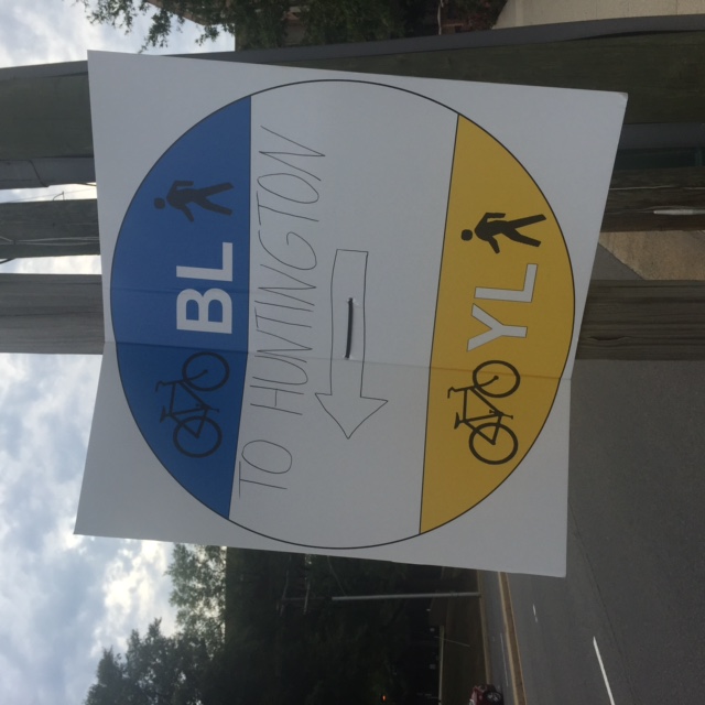
Photo by Joanne Pierce.
It’s not totally accurate— only the Yellow Line runs there— but it still lets people know how to get to the Metro.
Have these signs helped you? Are there upcoming events where similar temporary wayfinding for people on foot and bike would be helpful?