Google Maps gives DC the 3D treatment
For a number of years now, Google Maps has let you check out the buildings and topography of most medium to large cities, and increasingly even smaller towns, in 3D — but not DC. Now, nearly all of the District and parts of Arlington come in three dimensions.
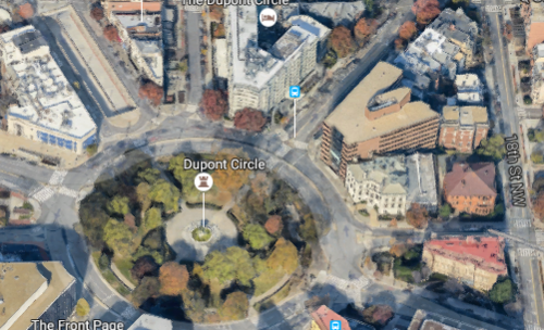
Image from Google Maps.
Initially, Google Maps only showed prominent landmarks in 3D, as models had to be crowded-sourced and created by hand with Google Sketchup, the company’s modeling software. Then in 2012, Maps rolled out a way of automating 3D generation through a process known as stereophotogrammetry.
Nearly all of DC is now included in the feature, as well as Rosslyn and National Airport.
Though the automated modeling process isn’t perfect, it really makes the city pop when you turn the feature on. To check it out, go to Google Maps, turn on satellite mode, and click the “3D” button in the bottom right. Be sure to rotate the view to get the full experience! Holding the control key will allow you to click-and-drag the camera angle.
Some of my favorite spots to view with the new feature are Woodley Park and the National Cathedral, Columbia Heights, the National Arboretum, and upper Georgia Avenue.
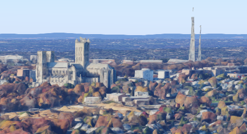
The National Cathedral in 3D.
There has been speculation that the reason DC was excluded from 3D display was for security reasons. The areas that were excluded from rendering seem to confirm that might have been the case: in DC, the areas around the National Mall, the White House, Federal Center SW, and Foggy Bottom are conspicuously absent from the feature.
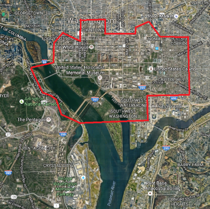
Image from Google Maps.
While you can now see the Rosslyn skyline from your computer, the rest of Northern Virginia and Maryland haven’t been included, though they may be added later.
Let us know what interesting things you find with the 3D feature!