Here are the answers to whichWMATA week 20
On Monday, we posted our twentieth photo challenge to see how well you know Metro. I took photos of five Metro stations. Here are the answers. How well did you do?
We got 19 guesses this week. 6 of you got all 5 correct. Great job, Alex B, MZEBE, Peter K, coneyraven, Roger F, and Phil.
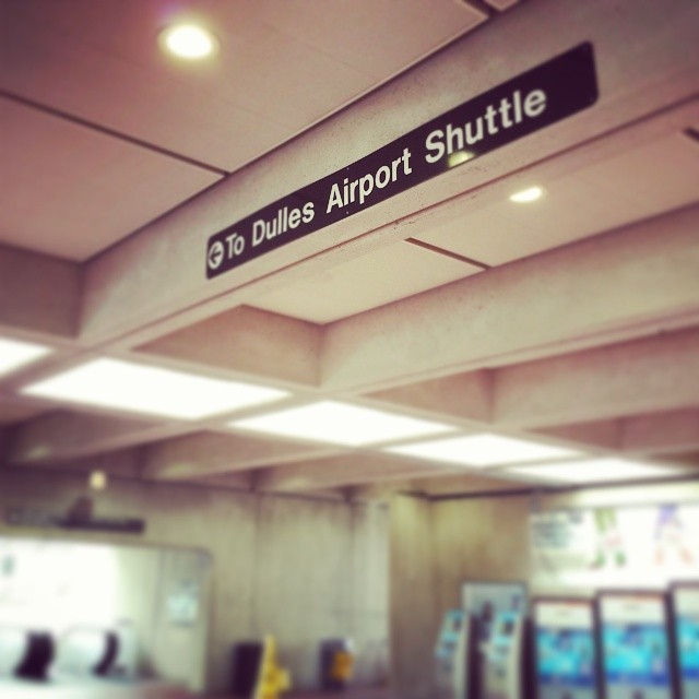
Image 1: West Falls Church
The first image is from the mezzanine of West Falls Church. The crucial clue here was the “Dulles Airport Shuttle” sign. It refers to the now-truncated DC Flyer service. I don’t know whether this sign is still in place. I took the photo last month. But despite that, the line of natural light coming in from the ceiling and the down escalator at the far left discounts underground Rosslyn and L’Enfant Plaza. Wiehle Avenue doesn’t have this kind of brutalist architecture, so it’s out too. 13 of you correctly guessed West Falls Church.
Image 2: Judiciary Square
The second image shows the western escalator entrance to Judiciary Square, in front of the National Building Museum. The District of Columbia City Hall is visible at center, which is a clear giveaway. Another clue is the pair of elevators, which drop directly to the platforms, bypassing the mezzanine. 16 of you knew this one.

Image 3: White Flint
The third image was a bit harder. It depicts the canopy at White Flint. This peaked-roof canopy is very similar to the canopies at most of the above-ground stations that opened in the 1980s and 1990s. But there’s a unique feature here: This canopy has tapered support beams. These tapers are not present anywhere else in the system on the beams running parallel to the tracks, though the taper is standard on the cross-beams. The office building visible through the glass may have tipped some of you off as well. 9 of you got this one right.
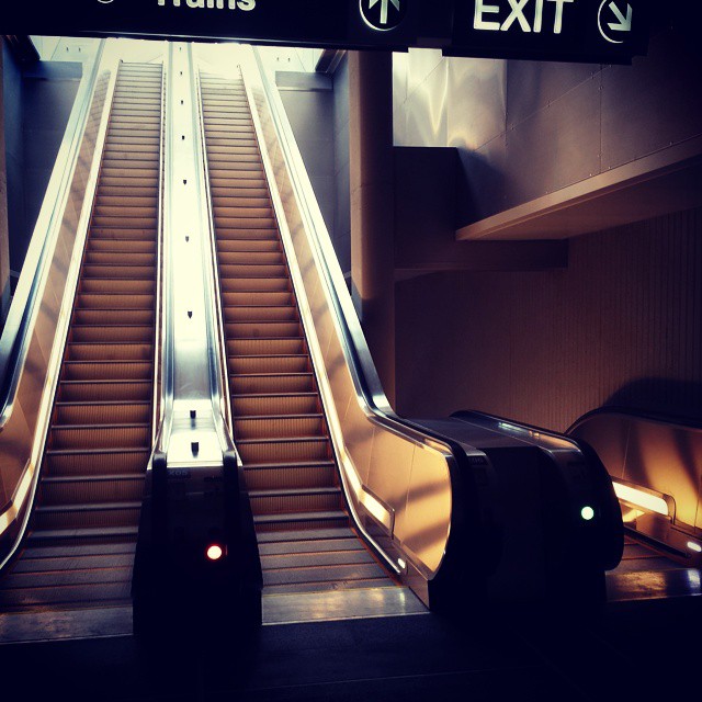
Image 4: Tysons Corner
The fourth image shows the set of 4 escalators at the western end of Tysons Corner station. Tysons Corner has two entrances. One is on the south side of Route 123, via a bridge over the roadway. It lands near Tysons Corner Center. But the other entrance is below the tracks, 2 levels below the mezzanine. These escalators lead from the mezzanine to a landing (where the photo was taken) and down to the north side of Route 123. Nine of you guessed this one correctly.
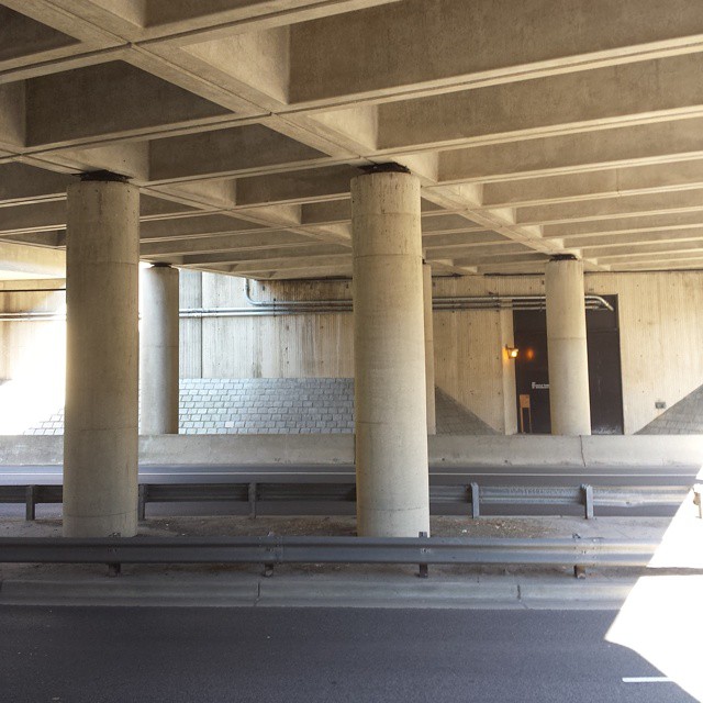
Image 5: East Falls Church
The final image shows the view out of the entrance to East Falls Church station. The road that’s visible is Sycamore Street, which runs under the tracks and platform (which are above the concrete lattice in the photo). The other clue is the bridge that carries the westbound lanes of I-66, just visible in the upper right corner. East Falls Church is the only median station in the system with an entrance below the tracks. 14 of you got this one right.
Next Monday we’ll have 5 more photos for you to identify. Thanks for playing!