Three ways Metro’s loop proposal could get better

Gallery Place crowding. Photo by the author.
Metro’s proposed loop has generated much discussion about the future of the transit system. While new capacity is an important goal, it’s not the only goal. Metro should also try to avoid designing in problems. A few tweaks could greatly improve the proposal.
One of the challenges of adding in a new crosstown line where one was never envisioned is dealing with transfers.
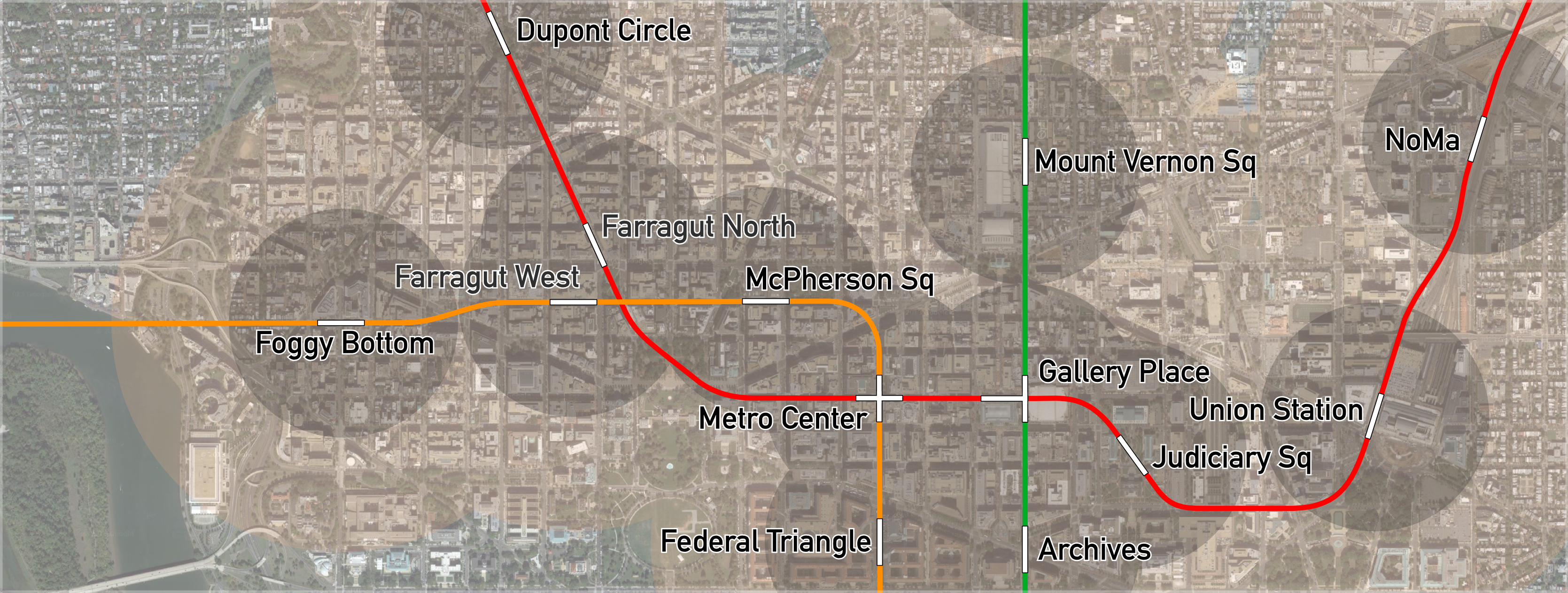
It’s absolutely essential that Metro get these transfer stations right. Today, Gallery Place is a nightmare due to its flawed design. That station was designed with two major flaws. The off-center meeting of the Green and Red Lines is due to the Red Line swinging south to Judiciary Square. The narrow platforms are because of the historic art museum upstairs. We’re still paying for a design decision made 40 years ago, and it really illustrates the need to get it right this time.
Metro’s loop proposal is still very nebulous because it’s so early in planning. Much could change. But the conceptual alignments shown in their map suggest the potential for inefficient transfer stations.
Building better transfer stations
At Waterfront, for example, the Green Line follows M Street. The proposed loop would run under Eye Street, 3 blocks north. Right now, riders from Alexandria and South Arlington have a straight shot on the Yellow Line to the 7th Street subway and the eastern side of downtown.

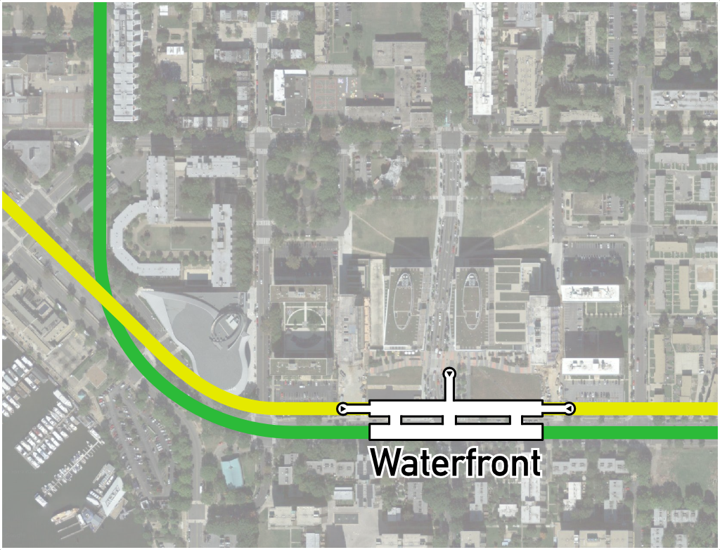
The station under Eye Street (top) and M Street (bottom). All graphics by the author.
If the new loop station is built at 4th and Eye, those riders will have to walk over 1,000 feet to change from the Yellow to the Green. That’s as long as the walk from Metro Center to Gallery Place. The additional inconvenience and time it takes to transfer will make transit less competitive for many riders. And it may create future crowding issues, like those faced at Gallery Place.
Locating the new station adjacent to the existing Waterfront stop would make transferring much easier and less time-consuming. And that would be a boon for many riders, especially those who would need to transfer under the new scheme, like anyone who takes the current Yellow Line from Virginia to downtown DC.
There’s an even better solution than just building the new station next to the old one: Build a new station for the Green Line and the loop line.

A four-track design like the one above would make transferring very easy. Many riders wouldn’t even need to use an escalator. Inbound trains would be on one level and outbound trains would be on another. This is exactly like the design of the Lionel-Groulx transfer station in Montreal.
This would probably not be possible as a reconstruction of the existing Waterfront station, but would probably need to be new construction adjacent to the current stop.
In this design, a commuter riding from Suitland to Union Station could simply exit her Green Line train at Waterfront and walk across the platform to board a Loop train on the outer loop headed toward Capitol South and Union Station.
Similarly, a person commuting from Huntington to Archives could get off his Yellow Line train at Waterfront and just walk right across the platform to a waiting Green Line train headed toward L’Enfant and Gallery Place.
Similar situations exist where the proposed loop line crosses the Red Line. Metro’s proposal seems to keep the new line under H Street near Union Station and under M Street where it crosses Connecticut Avenue.
The Red Line is currently Metro’s busiest line, and it provides access to many destinations. Forcing riders to make long walks is inefficient, and if the tunnels deposit riders at one end of the platform, a situation similar to the one at Gallery Place is likely to arise again.
The transfer at Farragut North/Longfellow isn’t as bad as the potential one at Waterfront. But the walk between the stops would still be almost 750 feet. Instead of keeping the line under M Street, the loop could swing down Vermont Avenue to either K or L Street. That would allow a much shorter transfer between the Red Line and the Orange Line as well.
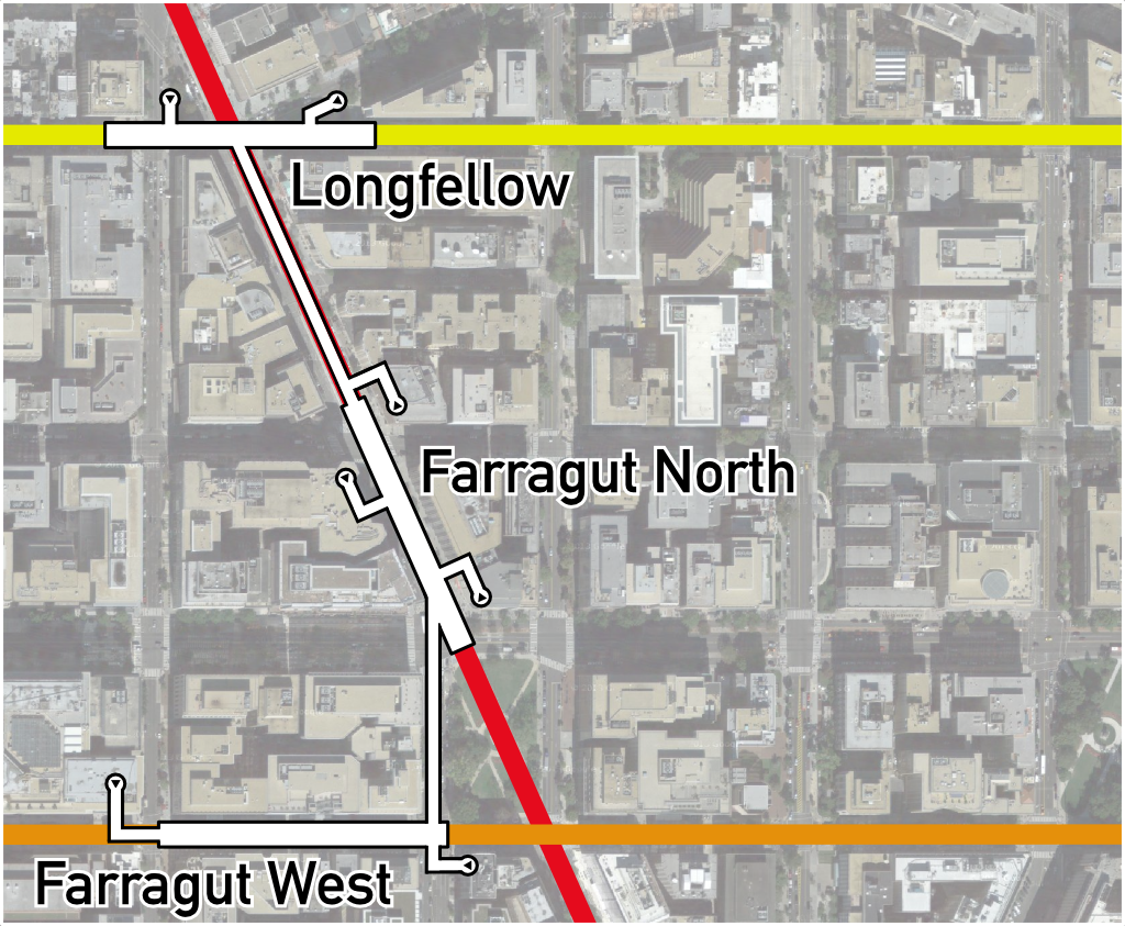
The Farragut station under M Street.
At Union Station, Amtrak has grand plans to expand the station and create a second front along H Street on the north side of the complex. In that regard, Metro’s loop wouldn’t be too inconvenient to commuter and Amtrak trains. Of course, if the redevelopment of the station doesn’t happen, riders would have a less pleasant trek to connect to their trains.
But the walk to connect to the congested north end of the Red Line platform is over 600 feet. And that means that riders connecting to trains bound for Metro Center or Silver Spring would also have an inconvenient transfer.
Locating the new loop station on the south side of the station, under Massachusetts Avenue, could make transfers much easier, and it wouldn’t sacrifice access to commuter or Amtrak trains either.
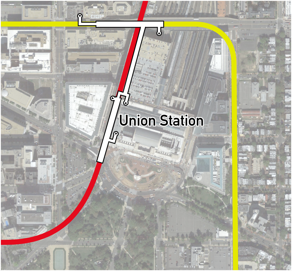
The Union Station station under H Street.
The Massachusetts Avenue alternative also seems to make it easier to extend the M Street subway east across Capitol Hill and/or the 2nd Street subway up North Capitol Street should future demand warrant that expansion. Ideally, the station under Massachusetts Avenue would include 4 tracks and 2 platforms so that if the loop were split into an east-west and a north-south line trains wouldn’t have to share tracks.
Tradeoffs
One of the bigger tradeoffs is the discussion of whether increasing the area within a 5 or 10 minute walk of transit is more important than easy transfers.
For example, if the new loop line is pulled down to K Street at Farragut Square, the West End station would be farther south, closer to the existing Foggy Bottom station. That means that less new territory would be within a 5 minute walk of Metro. On the other hand, essentially all of the West End is already within a 10 minute walk of Metro.
Compare some alternatives below. Note that the tan and gray areas are within 10 and 5 minute walks of existing stations. Light pink areas would be new areas within 10 minutes of Metro and dark pink areas would be new areas within 5 minutes of Metro.
Walksheds from existing stations.

Walksheds from Metro’s loop proposal.

Walksheds from a K Street/Mass Ave alternative.
Better transfer stations could mean fewer headaches for future commuters. But it might also mean less area is available for new development in the core, lowering tax revenues for the District. Co-locating stations is also likely to be more expensive and disruptive to riders. But in many cases, it may well be worth it. It’s certainly worth having the discussion.