Posts tagged Maps
-

Changes to DC’s Comprehensive Plan could mean more “missing middle” housing for the city
So far, the Office of Planning's Comprehensive Plan amendments solely focus on the introduction. Still, those changes indicate that OP recognizes that DC needs new homes everywhere, not just in “vacant” areas. Keep reading…
-

The first 60 pages of amendments to DC’s Comp Plan are out. Here’s a first look.
The Comp Plan describes the planning challenges DC faces, pointing forward towards future solutions and policies and guiding the actions and decisions of district agencies. Here's what you should know about the first set of amendments. Keep reading…
-

A bold California bill would ease transit oriented development. How would a similar approach affect DC?
A new bill before the California legislature would rezone every transit corridor in the state to permit mid-rise apartments. A similar approach would have a profound impact if it were applied to DC. Keep reading…
-

These graphs show where people are commuting by transit
Unsurprisingly, transit commuting is pretty popular around DC. Here's what else the data show about how the region stacks up to the rest of the country. Keep reading…
-

Peter Dovak, transit graphic designer, has died
Peter was known for his astounding design work, which included our logo and Metro map variations of many kinds, regional transit diagrams, and beautiful posters of transit vehicles. Keep reading…
-

This map lets you watch transit in action across the world in real time
This live map lets you see public transit in action across the world, and you can even find the bus or train you're riding in real time! Keep reading…
-

What’s spookier than arcing insulators? Our Halloween Metro map.
We made this map because we wanted to make Metro and Halloween puns. Pentagram City, Fearagut North, Shady Grave, or Bat-thesda anyone? Keep reading…
-

Identifying your block’s zoning is easy. Here’s how to do it.
Zoning ordinances might seem intimidating, but it's easier than you think to figure out what's allowed to be built in your area–promise. Here's a step-by-step guide to navigating local zoning codes: Keep reading…
-

Three things you need to know to get land-use woke
America’s history of land use is fundamentally racist, exclusionary, and exploitative. If we’re going to have productive conversations about where to go, we need to understand what got us here. Keep reading…
-
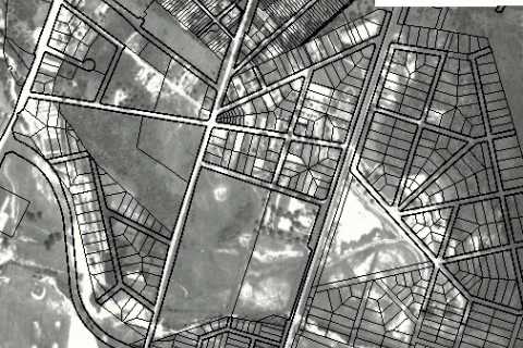
This online GIS atlas reveals the history of Prince George’s County
Hey history buffs: Prince George's Atlas has a slew of fascinating old aerial photos, maps, and other cartographic information about the county, including property boundaries and environmental information. What did your neighborhood look like a century ago? Keep reading…