Here are the answers to whichWMATA week 56
On Tuesday, we posted our fifty-sixth photo challenge to see how well you know Metro. I took five photos in the Metro system. Here are the answers. How well did you do?
This week, we got 40 guesses. Only three of you managed to get all five correct, though. Great work, transport., Peter K, Mr. Johnson, and FN!
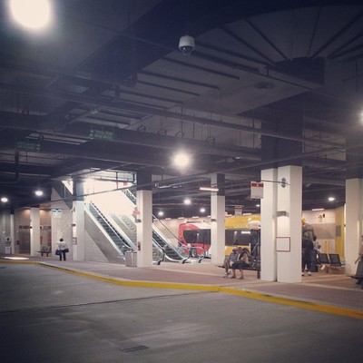
Image 1: Wiehle Avenue
The first image shows the northern bus loop at Wiehle Avenue station. This part of the station is underground, beneath the plaza and transit-oriented development where the north station entrance bridge lands. In addition to the unique design, one of the clues is the Fairfax Connector bus visible on the far side.
Thirty-five knew this one.
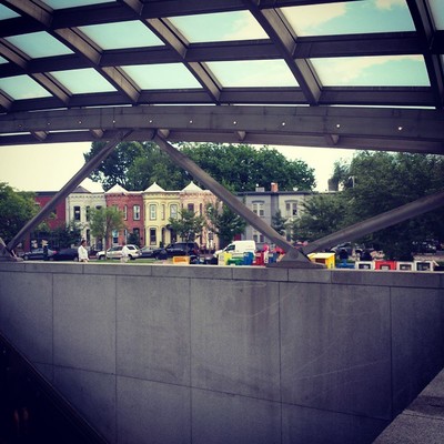
Image 2: Eastern Market
The next image shows the entrance to Eastern Market station. The row of houses in the distance is fairly distinctive. However, a second clue is the triangle of grass in the foreground, which is a part of the Eastern Market Metro Plaza, and sets this entrance apart from other possible contenders.
Thirty-one got this one right.
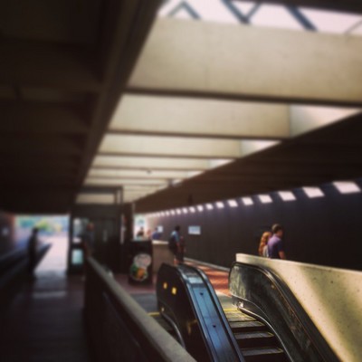
Image 3: East Falls Church
The third picture shows the platform at East Falls Church. The roof type here is general peak, but the ceilings at East Falls Church and Dunn Loring have a unique feature: the roof extends all the way over to the full-height walls across the tracks. A line of slits run along the walls letting in light.
The mezzanine at East Falls Church is under the platform, whereas at Dunn Loring it’s above the tracks and at one end. Since you can see the escalators descending here, this has to be East Falls Church.
Thirty-five figured this one out.
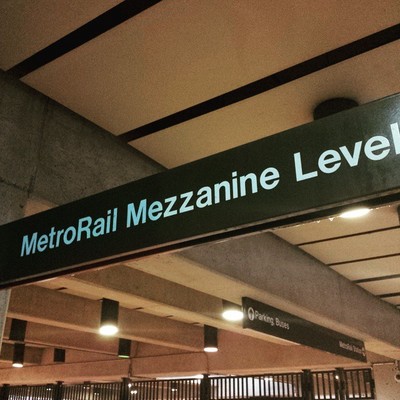
Image 4: Franconia-Springfield
This image proved to be the hardest. It’s a picture of signage at Franconia-Springfield. The reason for calling out “MetroRail Mezzanine Level” is because this sign is above the entrance to the station from the VRE platforms.
Several of you surmised that much, guessing stations with commuter rail connections. Seven were able to solve this puzzle.
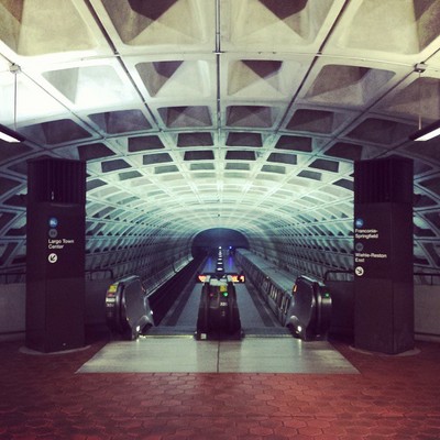
Image 5: Benning Road
The final image required some knowledge of the station layouts of Capitol Heights and Benning Road. Those are the only two stations shared by only the Blue and Silver Lines that are underground with a waffle-style vault.
While the pair of stations are essentially identical, they’re mirrors of each other. At Benning Road, the mezzanine is at the eastern end, while it’s at the western end at Capitol Heights. That means that, as pictured, at Benning Road, inbound trains are to the right, while Largo-bound trains are on the left.
Twenty-eight got this one right.
Thanks to everyone for playing! Great work. Stay tuned. We’ll have five more images for you next week.