“Diverging diamond” doesn’t help make a walkable corridor

Diverging diamond in Springfield, MO. Photo by MoDOT on Flickr.
An almost-finished plan for the Greenbelt Metro and MD-193 area aims to create pedestrian-friendly urban nodes in northern Prince George’s. But the county has decided to push a pedestrian and bike-unfriendly interchange in the middle of the corridor.
Prince George’s planners recently held their final meeting on the Sector Plan in Greenbelt. It caps months of hard work and civic engagement. But in a baffling move, the department chose this meeting to bring up the idea of transforming the Greenbelt Road/Kenilworth Avenue interchange into an even more anti-pedestrian environment by converting it to a “diverging diamond.”
None of the planners, and especially not the traffic engineer leading this part of the discussion, saw any conflict between turning one section of Greenbelt Road into a micro-freeway while turning the next block into a pedestrian-friendly urban district.
Diverging diamond: Faster traffic, worse for pedestrians
Diverging diamond interchanges (DDIs) are designed to move cars more efficiently by reducing the number of signal phases at interchanges and allowing cars on freeway on- and off-ramps to move freely without waiting for signals.
To accomplish this, the surface street lanes (not the freeway) cross to the opposite (left) side of the center line as they to pass through the interchange.

Diverging diamond diagram from Wikimedia.
Pedestrians have to cross to the median and walk between concrete walls, forcing them to cross half of the through lanes at each side of the bridge. In the case of the Greenbelt Road/
Kenilworth Avenue interchange, that would mean crossing 3 or 4 lanes (depending on the final configuration of the design) at each side of the bridge.
Alternatively, the design could accommodate pedestrians the outside of the roadway, but then they must cross the free-flowing left turn on- and off-ramps where drivers will be focusing on making the turn fast rather than looking for people crossing.
Incompatible with walkable vision for the corridor
What’s most troubling is that the planning department is actually trying to create an urban, pedestrian environment immediately west of the interchange, yet they still proposed this design which does the opposite.
Early on in the presentation, planners showed before and after renderings of their visions for a walkable urban node where Beltway Plaza is today. They showed a suburban arterial transformed into a narrowed street with wide sidewalks, street trees, pedestrian lighting, and bike lanes. At previous meetings, they talked of building a street grid, of filling in parking lots with development, and making it easier and safer to walk in these new urban nodes.
They also talked of finding ways to link the different neighborhoods of Greenbelt that have been separated from each other by the various freeways in the area. They specifically mentioned finding better ways of linking the Golden Triangle office park with the Beltway Plaza area — two neighborhoods that are currently separated from each other by Kenilworth Avenue and its interchange with Greenbelt Road.
But planners are approaching rebuilding the Kenilworth/Greenbelt with the objective of moving more cars, faster. They are not thinking about creating a pedestrian-friendly environment in that space. They are not thinking about making cyclists feel welcome on the road.
And encouraging drivers to speed up as they approach what planners hope to be a walkable node is asking for trouble.
The cure is far worse than the disease
Today, Greenbelt Road crosses above Kenilworth Avenue at an interchange built in the 1980s. Most would agree that the intersection has its problems, mostly from the way the northbound ramps are offset and the close spacing of the north- and southbound off-ramps.
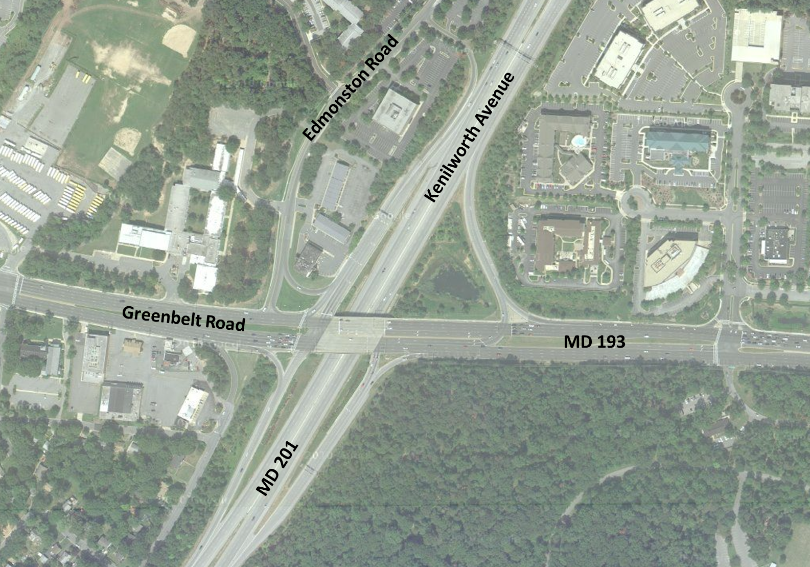
Image modified from Google Maps.
But the solution the county planners propose would be far worse than the current setup, especially for pedestrians and cyclists.
It is questionable why the county wants to focus on this intersection to begin with. It’s not “failing” by traffic engineer standards, and in terms of driver delay, it’s not even the worst intersection in the corridor, according to a study conducted in conjunction with the Sector Plan. But of course, highway engineers like to “fix” things whether or not they’re broken.
Strong Towns executive director Chuck Marohn narrated a video about a DDI in Springfield, Missouri. A traffic engineer involved in the design created the video, touting how a pedestrian can walk through the interchange, but Marohn points out how absurd it is to say that this is actually pedestrian-friendly.
Marohn notes that while a DDI provides a path for pedestrians and cyclists, it’s nothing like the kind of interchange one would design if the goal from the start were to make a space friendly to people walking and biking.
Building walkable communities and complete streets has to be more than an engineer running down an accommodation checklist. If we’re trying to create a neighborhood where walkability is a primary goal, then pedestrians, cyclists, and transit users have to be a top priority, not just get the leftover road space and the bare minimum listed in the design guide.
The nascent urban districts at White Flint and Tysons Corner are transforming from suburbs to more walkable spaces. And like the Beltway Plaza area, pedestrians in those areas face barriers in the form of interchanges. Prince George’s can’t simply get rid of their interchanges, but they don’t need to make the pedestrian condition worse by recommending converting an interchange to one that’s sole purpose is to move cars more quickly.