14th Street bridge area needs a good bicycle connection
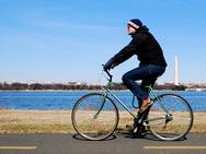
Photo by M.V. Jantzen on Flickr.
Bicycling to and from the 14th Street bridge on the DC side is not a pleasant experience. Cyclists must choose between harrowing high-speed roadways, too-narrow sidewalks, or long detours. The 14th Street Bridge EIS doesn’t address this connection, but it needs to, immediately.
The Mount Vernon Trail, along the Potomac River in Virginia, has a few faults but it provides a safe and well-used bicycle route. It connects to a bike and pedestrian path on the George Mason bridge (the northernmost of the 3 road bridges) which is 8 feet wide, narrower than what AASHTO recommends. Still, many use this path even though it’s adjacent to highway traffic.
In DC, there are some excellent bicycle facilities like the 15th Street bike lane, but it doesn’t go any farther south than Pennsylvania Avenue. The Mall is also fairly bicycle-friendly for east-west travel.
The problem is getting from 15th and Pennsylvania, or the Mall, to the Mason Bridge.
Someone riding south on the 15th Street lane has to merge into busy traffic and then cross the Mall either by riding on the sidewalk, which is often quite crowded with tourists and joggers, or in the road, where cars expect to drive fast and not encounter cyclists. The last time David rode there, a DC taxi pulled up right behind and started honking, even though there was another, mostly empty lane it could switch into. It eventually did, honking even more.
It gets worse around Maine Avenue and Ohio Drive, near the Tidal Basin. Not only is the pavement in this area in horrible condition, but those roads are configured like highways with cars speeding along the winding curves. The sidewalks are extremely narrow and packed with pedestrians, especially during warm, sunny weather and in Cherry Blossom season.
The pedestrians deserve to use that space, but what do cyclists do? Riding in the road is only an option for southbound bicyclists, and it’s a harrowing experience with the curved yet high-speed roads and drivers traveling very fast.

Bicycle issues near the bridge. Image from Google Maps.
In the other direction, there isn’t really a choice. From the path over the Mason Bridge, a cyclist has to ride on the sidewalks around the Tidal Basin, go the long way around west of the Tidal Basin toward the Lincoln Memorial, or take a long detour through East Potomac Park to get to the eastern side Ohio Drive and then head back up through the Maine Avenue area.
From Southwest DC, there’s a path along the Case Bridge, which carries I-395 over the Washington Channel, but to get to it you have to navigate across and around highway-style ramps in Banneker Park, then 2 narrow switchbacks which force dismounting.
On the East Potomac Park side, the path turns into a narrow sidewalk along the on-ramp from the Park Police headquarters. Riders have to travel though the NPS parking lot (or go farther out of the way), then ride along the western Ohio Drive past the George Mason Memorial to get to the path.
On the Virginia side, the Mount Vernon Trail connects to many trails, but has no direct connection from the 14th Street bridge area to Pentagon City right across the freeways. Someone riding there has to either head north through Lady Bird Johnson Park and then wind around the Pentagon parking lots, or go south to the airport and then backtrack through Crystal City.
Alternatives improve Virginia connections
The Draft Environmental Impact Statement suggests 3 alternatives. The most ambitious, Alternative 2, proposes a new bridge from western Ohio Drive across the Potomac along side the Long Bridge (the CSX and VRE tracks) and then over the GW Parkway, with access to both the Mount Vernon Trail and Long Bridge Park.
The connection in Virginia seems great, but dumping cyclists in East Potomac Park isn’t that useful. It’s a little closer to the Case Bridge path, but not much, and getting to downtown or the Mall is worse than today’s existing bridge.
The DEIS also contains 2 other, smaller bicycle proposals. Alternative 1 slightly widens and makes some changes to the approaches to the Mason Bridge path on each side, connecting to the Mount Vernon Trail and to the Jefferson Memorial. An earlier version also proposed widening the bike/ped path on the George Mason Bridge, but this bridge widening was removed from the alternative for “technical complexity.” The final EIS ought to reconsider this option.
Alternative 3 has two parts. One would create better and more consistent wayfinding signage on both sides of the river. The second part proposes new trail connections to the Pentagon and in Pentagon City.
Around the Pentagon, a new connection would extend the half-built trail under the Humpback Bridge over to Boundary Channel Drive, providing a more direct connection between the 14th Street Bridge and the Pentagon. In Pentagon City, it would create a better bike connection from the north end of Crystal City (12th and Clark) west along Army-Navy Drive, under I-395, and along the south edge of the Pentagon Reservation to Columbia Pike and the Washington Blvd trail.

Proposed trail connections in Virginia. Labels added to base image from the EIS.
DC needs better bike connections as well
The Virginia connections would significantly improve access to the bridges, but there are no comparable bike connections proposed on the DC side of the river. This is the most glaring missing piece in the DEIS. The team should study and propose a better connection to 15th Street.
Drivers have direct connections in all directions here, even having too many ramps to too many roads. Cyclists, meanwhile, have one bad connection southbound from downtown and none at all northbound, and poor and winding connections to other directions.
This isn’t just a recreational amenity. Many already use the bridge for commuting. Many more likely would for both commuting and general transportation if there were a clear, direct, and safe connection.
Ideally, we could find a way to extend the 15th Street cycle track from Pennsylvania down through the Mall, then past or through the Maine Avenue/
East Basin Drive area up to either the Mason Bridge path or a new bridge.
WashCycle suggests extending the new bridge along the railroad tracks across East Potomac Park to the east side, where it’s a lot closer to the mainland. Another option is to convert 1 lane on East Basin Drive (the 2-lane road from Maine Avenue to I-395 South and the Jefferson Memorial) into a 2-way bicycle facility up to Maine Avenue, and eventually connect through the Mall to the 15th Street lanes.
What do you think is the best way to create a connection between the Mall and downtown across the Potomac?