Low local bus ridership in Prince George’s: it’s the system, not the land use
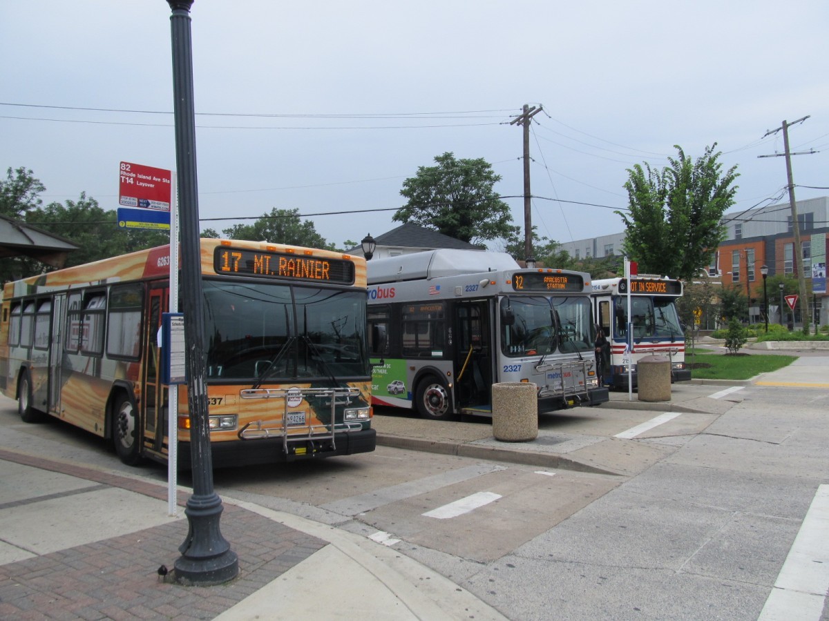
Great local bus service in Prince George's County is justified by demand and equity considerations. Image by Bryan Barnett-Woods.
This post is part of an ongoing series about how Prince George’s County could improve TheBus, its public bus system. You can read the previous post here.
Prince George's County has been slower to urbanize than the other suburban counties surrounding Washington, DC. There are a lot of clear historic reasons for this, but rapid growth in recent years means the county is playing catchup. The current land use pattern in the county justifies much better local bus service than it currently provides.
Which comes first, the chicken or the egg?
There is a well-established relationship between how many people want to get around using transit and land use patterns. While most research on how dense a place needs to be to support transit has focused on fixed systems like rail, there is some evidence globally that roughly 15 residents and/or jobs per acre is a key intensity threshold where automobile dependence falls off.
In a jurisdiction like Prince George's, local bus ridership could be low because the land use pattern is not dense enough to support a functioning system.
These maps show residents per acre and jobs per acre for DC and the immediately adjacent suburban jurisdictions at the Census block group level using, respectively, the 2016 American Community Survey five-year estimates and the 2014 Longitudinal Employer-Household Dynamics Origin-Destination Employment Statistics.
Image by the author.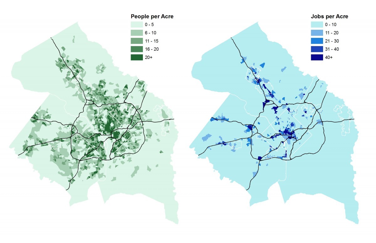
These maps show clear differences between Prince George's County and its suburban counterparts around DC. First, there is relatively little residential or commercial land use outside of the Beltway in Prince George's compared to Montgomery County or Northern Virginia.
Second, it is particularly notable that College Park, and to a lesser extent Prince George's Plaza and New Carrollton*, are the only major job centers in Prince George's. The District, Montgomery County, and Northern Virginia have many more (as has already been observed by many others).
However, the point remains that Prince George's County does have some major job centers, and residential densities inside the Beltway comparable to Montgomery County. So let's take a closer look inside the Beltway.
Image by the author.
With the Metrorail system overlaid, we once again see a clear difference between Prince George's County and other jurisdictions. The densest population center in the state of Maryland, Langley Park, is not served by Metrorail. The ultimate right-of-way and station location of the College Park Metrorail station swerves to avoid the most important job center in the county.
The transit-oriented development opportunities at stations such as Prince George's Plaza and New Carrollton have not reached the maturity of comparable peer stations in Montgomery County and Northern Virginia. And transit-oriented development has not taken root at all at the southern end of the Green Line or the eastern end of the Blue/Orange/Silver line.
This land use reality means that Metrorail in Prince George's County primarily functions to provide transit access to more distant activity centers in DC and beyond. This only increases the importance of local bus service within the county to serve the job centers in College Park and New Carrollton, and to connect residents with Metrorail. The residential density to support transit is clearly visible inside the Beltway.
Prince George's County can support great bus transit
Combining residents and jobs into “activity units,” and applying the threshold from the literature of 15 units/acre, yields the following maps.
Image by the author.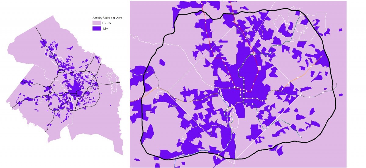
The significance of the Beltway boundary for Prince George's really pops in these maps. By missing out on development in the 80s and 90s, does Prince George's have a chance to restrain sprawl that has already passed for neighboring Montgomery? The need to prioritize transit connectivity and future development within the Beltway also seems clear. (Sorry, Laurel.)
However, it should be noted that the very general aggregation visualized on these maps conceals considerable variation.
Average weekday bus ridership in this table is a combination of data from the Federal Transit Administration's National Transit Database for TheBus, RideOn, the Fairfax Connector, DASH, and ART, and jurisdictional data from WMATA. These data thus represent back-of-the-envelope rough estimates as the dates and geographies on the datasets don't quite line up. Image by the author.
While we see from the maps that Prince George's has plenty of areas within the Beltway that can support transit, it is important to note that it is not reasonable to expect the ridership levels of Northern Virginia or Montgomery County. There is still a clear difference between these jurisdictions, and in fact Prince George's County has the lowest weekday bus ridership of the inner-Beltway areas, as one might expect based on this table, given the lower activity density of the county.
However, we can also see from the table that activity density is not the only predictor of bus transit use. We can guess the relationship is not simply linear — Prince George's County has twice the average weekday bus rider share relative to their activity unit share, while DC and Northern Virginia are relatively underrepresented among riders.
Why get fired up about transit access in Prince George's County?
Households with relatively lower median incomes in our region are concentrated in Prince George's County. Of the estimated 411,690 county residents inside the Beltway, 283,857 (69%) live in Census block groups were the median household income is $70,000 or less (the area median income for a household of two is $86,880).
Map of Census block groups by median income; the white areas show places where the median is zero, in other words where nobody lives. Image by the author._1200_927_90.jpg)
These are the households for which car ownership is a stressful paradox. It is a critical means of access to opportunity, health care, and civic institutions, while at the same time being a tremendous financial burden and a potential gateway to poverty. High quality transit service is the hammer that can break these chains.
The Transit Vision Plan
As we've blogged about TheBus in this series, Prince George's County has been working on a Transit Vision Plan. The preliminary service improvement recommendations are now available. They include improvements to many of the issues we've highlighted in this series, including extending service to evenings and Saturdays, improvements to route design and service frequency, and connecting activity centers. We're still waiting for the timeline for implementation — expected on May 7, 2018 — as of this posting.
Prince George's County can support transit, though there is always room for more and better transit-oriented development in the future. In the present, improving the existing local bus service can have a dramatic impact on the county's quality of life.
*The maps show a job center at Riverdale Park, but this is an error due to the fact that the L(EHD)-ODES database is based on tax records. The M-NCPPC executive office building is in Riverdale Park, but employee job sites are actually located throughout the county.
Note: The final image of this post has been updated to display areas where no one lives to better show which areas are truly low-income.